
From Copenhagen to Stockholm Metropolitan Area
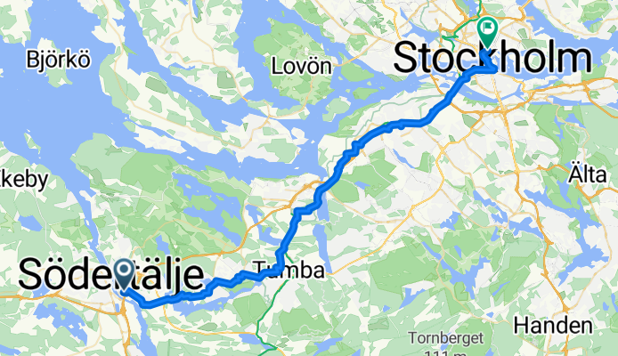
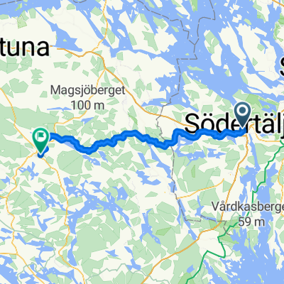
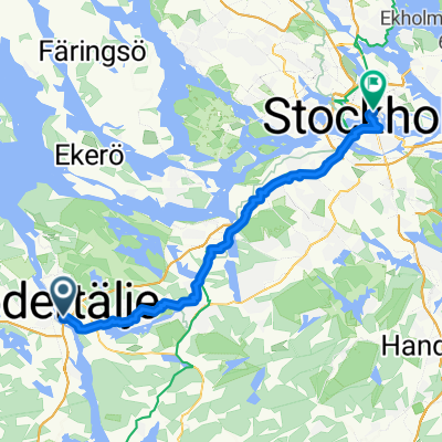
Vagnhärad - Stockholm
A cycling route starting in Södertälje, Stockholm County, Sweden.
Overview
About this route
- 2 h 16 min
- Duration
- 39.9 km
- Distance
- 430 m
- Ascent
- 427 m
- Descent
- 17.5 km/h
- Avg. speed
- 70 m
- Max. altitude
Part of
Route quality
Waytypes & surfaces along the route
Waytypes
Cycleway
32.7 km
(82 %)
Quiet road
3.2 km
(8 %)
Surfaces
Paved
34.7 km
(87 %)
Unpaved
1.2 km
(3 %)
Asphalt
21.5 km
(54 %)
Paved (undefined)
13.2 km
(33 %)
Continue with Bikemap
Use, edit, or download this cycling route
You would like to ride Vagnhärad - Stockholm or customize it for your own trip? Here is what you can do with this Bikemap route:
Free features
- Save this route as favorite or in collections
- Copy & plan your own version of this route
- Sync your route with Garmin or Wahoo
Premium features
Free trial for 3 days, or one-time payment. More about Bikemap Premium.
- Navigate this route on iOS & Android
- Export a GPX / KML file of this route
- Create your custom printout (try it for free)
- Download this route for offline navigation
Discover more Premium features.
Get Bikemap PremiumFrom our community
Other popular routes starting in Södertälje

Edge 820®
Södertälje Cycling- Distance
- 27.5 km
- Ascent
- 345 m
- Descent
- 350 m
- Location
- Södertälje, Stockholm County, Sweden
 season opening
- Distance
- 33.8 km
- Ascent
- 456 m
- Descent
- 457 m
- Location
- Södertälje, Stockholm County, Sweden
 Södertälje centrum naar Torggatan
- Distance
- 76.9 km
- Ascent
- 977 m
- Descent
- 936 m
- Location
- Södertälje, Stockholm County, Sweden
 Södertälje - Mälarbaden etapp syd
- Distance
- 113.5 km
- Ascent
- 959 m
- Descent
- 961 m
- Location
- Södertälje, Stockholm County, Sweden
 Vagnhärad - Stockholm
- Distance
- 39.9 km
- Ascent
- 430 m
- Descent
- 427 m
- Location
- Södertälje, Stockholm County, Sweden
 Södertälje - Örebro Dag 1: Södertälje - Eklången
- Distance
- 72 km
- Ascent
- 805 m
- Descent
- 799 m
- Location
- Södertälje, Stockholm County, Sweden
 Summer 2021 - Södertälje till Vänersborg
- Distance
- 448.4 km
- Ascent
- 494 m
- Descent
- 463 m
- Location
- Södertälje, Stockholm County, Sweden
 Kakslottet
- Distance
- 25.4 km
- Ascent
- 299 m
- Descent
- 326 m
- Location
- Södertälje, Stockholm County, Sweden
Open it in the app