
Von Blankenstein bis Dresden
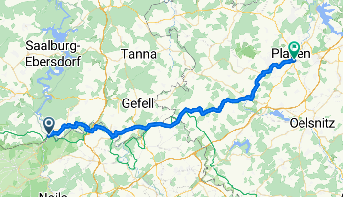
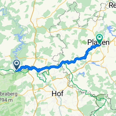
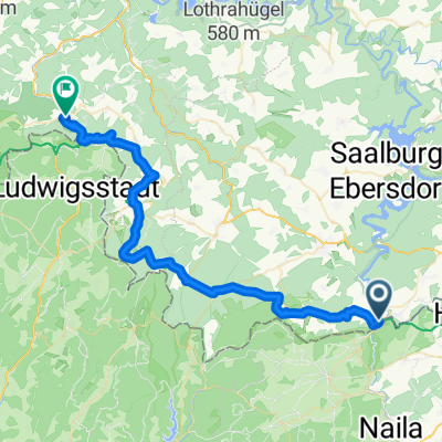
Blankenstein - Plauen
A cycling route starting in Blankenstein, Thuringia, Germany.
Overview
About this route
- 2 h 36 min
- Duration
- 44.3 km
- Distance
- 630 m
- Ascent
- 735 m
- Descent
- 17 km/h
- Avg. speed
- 603 m
- Max. altitude

Part of
Von Blankenstein bis Dresden
4 stages
Route quality
Waytypes & surfaces along the route
Waytypes
Quiet road
22.1 km
(50 %)
Road
14.2 km
(32 %)
Surfaces
Paved
27.9 km
(63 %)
Unpaved
0.4 km
(1 %)
Asphalt
22.1 km
(50 %)
Paved (undefined)
5.8 km
(13 %)
Continue with Bikemap
Use, edit, or download this cycling route
You would like to ride Blankenstein - Plauen or customize it for your own trip? Here is what you can do with this Bikemap route:
Free features
- Save this route as favorite or in collections
- Copy & plan your own version of this route
- Sync your route with Garmin or Wahoo
Premium features
Free trial for 3 days, or one-time payment. More about Bikemap Premium.
- Navigate this route on iOS & Android
- Export a GPX / KML file of this route
- Create your custom printout (try it for free)
- Download this route for offline navigation
Discover more Premium features.
Get Bikemap PremiumFrom our community
Other popular routes starting in Blankenstein
 Radtour 2011 - Rennsteig
- Distance
- 164.4 km
- Ascent
- 1,418 m
- Descent
- 1,628 m
- Location
- Blankenstein, Thuringia, Germany
 Blankenstein - Plauen
- Distance
- 44.3 km
- Ascent
- 630 m
- Descent
- 735 m
- Location
- Blankenstein, Thuringia, Germany
 Rennsteig: Blankenstein - Hörschel
- Distance
- 165 km
- Ascent
- 1,273 m
- Descent
- 1,497 m
- Location
- Blankenstein, Thuringia, Germany
 Saaleradweg Etappe 3 - Von Blankenstein nach Ziegenrück
- Distance
- 44.1 km
- Ascent
- 789 m
- Descent
- 915 m
- Location
- Blankenstein, Thuringia, Germany
 SRW_Etappe3
- Distance
- 38.4 km
- Ascent
- 528 m
- Descent
- 635 m
- Location
- Blankenstein, Thuringia, Germany
 Grünes Band 2. Etappe
- Distance
- 43.1 km
- Ascent
- 848 m
- Descent
- 952 m
- Location
- Blankenstein, Thuringia, Germany
 Blankenstein -Hörschel
- Distance
- 192 km
- Ascent
- 1,196 m
- Descent
- 1,419 m
- Location
- Blankenstein, Thuringia, Germany
 RSSL_2012_1
- Distance
- 16.7 km
- Ascent
- 401 m
- Descent
- 120 m
- Location
- Blankenstein, Thuringia, Germany
Open it in the app