
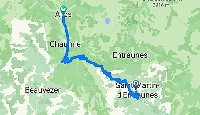
St. Martin d’Entraunes – Col des Champs – Allos
Cycling route
Overview
About this route
- 2 h 27 min
- Duration
- 36.1 km
- Distance
- 2,084 m
- Ascent
- 1,695 m
- Descent
- 14.8 km/h
- Avg. speed
- 2,127 m
- Max. altitude
cuboviaggiatore

created this 1 month ago
Route quality
Waytypes & surfaces along the route
Waytypes
Road
28.2 km
(78 %)
Quiet road
0.7 km
(2 %)
Undefined
7.2 km
(20 %)
Surfaces
Paved
17.7 km
(49 %)
Asphalt
17.7 km
(49 %)
Undefined
18.4 km
(51 %)
Continue with Bikemap
Use, edit, or download this cycling route
You would like to ride St. Martin d’Entraunes – Col des Champs – Allos or customize it for your own trip? Here is what you can do with this Bikemap route:
Free features
- Save this route as favorite or in collections
- Copy & plan your own version of this route
- Sync your route with Garmin or Wahoo
Premium features
Free trial for 3 days, or one-time payment. More about Bikemap Premium.
- Navigate this route on iOS & Android
- Export a GPX / KML file of this route
- Create your custom printout (try it for free)
- Download this route for offline navigation
Discover more Premium features.
Get Bikemap PremiumOpen it in the app