
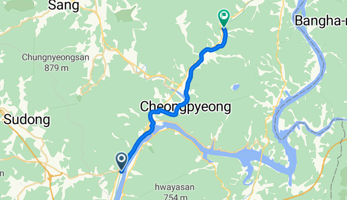
청평면 388-14 ~ 청평면 118-1
A cycling route starting in Cheongpyeong, Gyeonggi-do, South Korea.
Overview
About this route
첫라이딩. ㆍ 25 년 11월 1일 오전. 7시45분 부터 오전. 9시50분
- 52 min
- Duration
- 15.4 km
- Distance
- 201 m
- Ascent
- 102 m
- Descent
- 17.6 km/h
- Avg. speed
- 137 m
- Max. altitude

Route quality
Waytypes & surfaces along the route
Waytypes
Cycleway
12.1 km
(79 %)
Quiet road
2.8 km
(18 %)
Road
0.5 km
(3 %)
Surfaces
Paved
13.5 km
(88 %)
Asphalt
13.5 km
(88 %)
Undefined
1.8 km
(12 %)
Continue with Bikemap
Use, edit, or download this cycling route
You would like to ride 청평면 388-14 ~ 청평면 118-1 or customize it for your own trip? Here is what you can do with this Bikemap route:
Free features
- Save this route as favorite or in collections
- Copy & plan your own version of this route
- Sync your route with Garmin or Wahoo
Premium features
Free trial for 3 days, or one-time payment. More about Bikemap Premium.
- Navigate this route on iOS & Android
- Export a GPX / KML file of this route
- Create your custom printout (try it for free)
- Download this route for offline navigation
Discover more Premium features.
Get Bikemap PremiumFrom our community
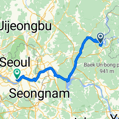
Other popular routes starting in Cheongpyeong
 청평역-프리스턴-유명/중미산-북한강길-팔당역
- Distance
- 57 km
- Ascent
- 808 m
- Descent
- 781 m
- Location
- Cheongpyeong, Gyeonggi-do, South Korea
 Home to work
- Distance
- 5.3 km
- Ascent
- 294 m
- Descent
- 165 m
- Location
- Cheongpyeong, Gyeonggi-do, South Korea
 청평역-프리스턴-유명/중미산-벗고개-팔당역
- Distance
- 75.2 km
- Ascent
- 974 m
- Descent
- 945 m
- Location
- Cheongpyeong, Gyeonggi-do, South Korea
 가평-유명산-명달고개-다락재-가평
- Distance
- 51.3 km
- Ascent
- 1,059 m
- Descent
- 1,059 m
- Location
- Cheongpyeong, Gyeonggi-do, South Korea
 From Hotel Haus to Mondrian Hotel
- Distance
- 82.3 km
- Ascent
- 968 m
- Descent
- 1,000 m
- Location
- Cheongpyeong, Gyeonggi-do, South Korea
 청평-중미산-팔당역
- Distance
- 66.1 km
- Ascent
- 878 m
- Descent
- 894 m
- Location
- Cheongpyeong, Gyeonggi-do, South Korea
 가평-쁘띠프랑스-호명산-가평
- Distance
- 46.1 km
- Ascent
- 660 m
- Descent
- 663 m
- Location
- Cheongpyeong, Gyeonggi-do, South Korea
![Ph0]에서 경로가평읍 649-2](https://media.bikemap.net/routes/17630092/gallery/thumbs/e9263864-ce04-4e0d-a225-c5a2e3e2167c.jpg.208x208_q80_crop.jpg) Ph0]에서 경로가평읍 649-2
Ph0]에서 경로가평읍 649-2- Distance
- 43.3 km
- Ascent
- 445 m
- Descent
- 589 m
- Location
- Cheongpyeong, Gyeonggi-do, South Korea
Open it in the app