
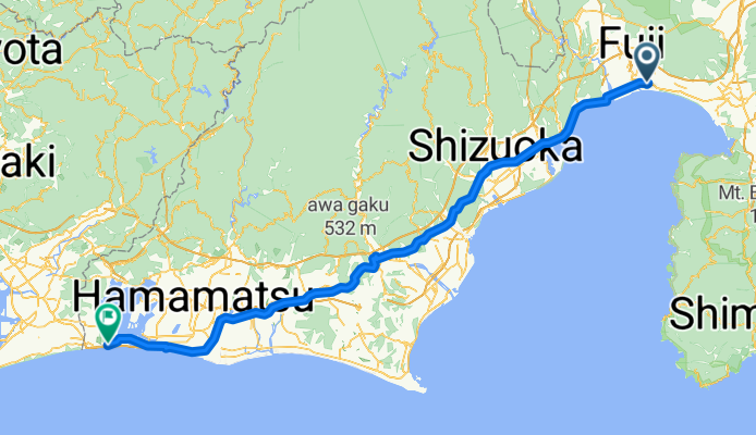
Overview
About this route
- 8 h 24 min
- Duration
- 139.4 km
- Distance
- 335 m
- Ascent
- 264 m
- Descent
- 16.6 km/h
- Avg. speed
- 196 m
- Max. altitude

Part of
Japan: Osaka To Tokyo
3 stages
Continue with Bikemap
Use, edit, or download this cycling route
You would like to ride Fuji - Kosai-shi or customize it for your own trip? Here is what you can do with this Bikemap route:
Free features
- Save this route as favorite or in collections
- Copy & plan your own version of this route
- Split it into stages to create a multi-day tour
- Sync your route with Garmin or Wahoo
Premium features
Free trial for 3 days, or one-time payment. More about Bikemap Premium.
- Navigate this route on iOS & Android
- Export a GPX / KML file of this route
- Create your custom printout (try it for free)
- Download this route for offline navigation
Discover more Premium features.
Get Bikemap PremiumFrom our community
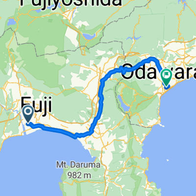
Other popular routes starting in Fuji
 Day 11: Fuji River - Lake Yamanaka
- Distance
- 77.2 km
- Ascent
- 1,283 m
- Descent
- 324 m
- Location
- Fuji, Shizuoka, Japan
 Length of Japan Tokaido Fuji river-Kakegawa city
- Distance
- 96.2 km
- Ascent
- 379 m
- Descent
- 372 m
- Location
- Fuji, Shizuoka, Japan
 De Fuji a 273-1, Fujinomiya
- Distance
- 24.9 km
- Ascent
- 508 m
- Descent
- 34 m
- Location
- Fuji, Shizuoka, Japan
 富士リバービューロード
- Distance
- 43.3 km
- Ascent
- 0 m
- Descent
- 0 m
- Location
- Fuji, Shizuoka, Japan
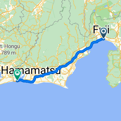
 Yaizu - Fuji
- Distance
- 86.4 km
- Ascent
- 1,237 m
- Descent
- 1,243 m
- Location
- Fuji, Shizuoka, Japan
 Day 4 Fuji to Yoshida
- Distance
- 65.1 km
- Ascent
- 198 m
- Descent
- 165 m
- Location
- Fuji, Shizuoka, Japan
 Fuji - Kosai-shi
- Distance
- 139.4 km
- Ascent
- 335 m
- Descent
- 264 m
- Location
- Fuji, Shizuoka, Japan
 8-9, Heigakihoncho, Fuji to 1338-41, Miho, Shimizu, Shizuoka
- Distance
- 32.9 km
- Ascent
- 120 m
- Descent
- 123 m
- Location
- Fuji, Shizuoka, Japan
Open it in the app