
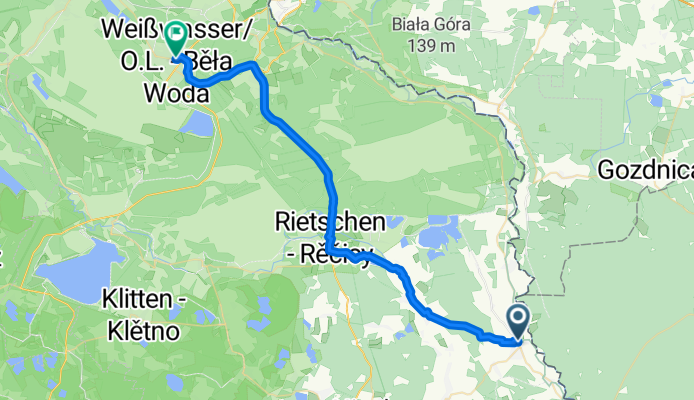
Pieńsk - Weißwasser/Oberlausitz
A cycling route starting in Pieńsk, Lower Silesian Voivodeship, Poland.
Overview
About this route
- 2 h 5 min
- Duration
- 38.1 km
- Distance
- 113 m
- Ascent
- 141 m
- Descent
- 18.2 km/h
- Avg. speed
- 173 m
- Max. altitude

Route quality
Waytypes & surfaces along the route
Waytypes
Path
18.7 km
(49 %)
Road
8.4 km
(22 %)
Surfaces
Paved
29.7 km
(78 %)
Unpaved
0.4 km
(1 %)
Asphalt
29.3 km
(77 %)
Concrete
0.4 km
(1 %)
Continue with Bikemap
Use, edit, or download this cycling route
You would like to ride Pieńsk - Weißwasser/Oberlausitz or customize it for your own trip? Here is what you can do with this Bikemap route:
Free features
- Save this route as favorite or in collections
- Copy & plan your own version of this route
- Sync your route with Garmin or Wahoo
Premium features
Free trial for 3 days, or one-time payment. More about Bikemap Premium.
- Navigate this route on iOS & Android
- Export a GPX / KML file of this route
- Create your custom printout (try it for free)
- Download this route for offline navigation
Discover more Premium features.
Get Bikemap PremiumFrom our community
Other popular routes starting in Pieńsk
 Rothenburg -- Bad Muskau Lange Radrunde vom 25. Mai 10:28
- Distance
- 42.4 km
- Ascent
- 144 m
- Descent
- 189 m
- Location
- Pieńsk, Lower Silesian Voivodeship, Poland
 2 etap, Rothenburg - Kromlau - Halbendorf - Bad Muskau - Nowe Czaple
- Distance
- 71.5 km
- Ascent
- 466 m
- Descent
- 473 m
- Location
- Pieńsk, Lower Silesian Voivodeship, Poland
 à Dworcowa Legnica
- Distance
- 125.6 km
- Ascent
- 599 m
- Descent
- 633 m
- Location
- Pieńsk, Lower Silesian Voivodeship, Poland
 Rothenburg - Deulowitzer See
- Distance
- 108.1 km
- Ascent
- 115 m
- Descent
- 208 m
- Location
- Pieńsk, Lower Silesian Voivodeship, Poland
 Przewóz - Brody
- Distance
- 40.4 km
- Ascent
- 279 m
- Descent
- 328 m
- Location
- Pieńsk, Lower Silesian Voivodeship, Poland
 Oder-Neiße-Radweg Tag 3
- Distance
- 108.4 km
- Ascent
- 349 m
- Descent
- 470 m
- Location
- Pieńsk, Lower Silesian Voivodeship, Poland
- Pieńsk-Gubin
- Distance
- 126.8 km
- Ascent
- ---
- Descent
- ---
- Location
- Pieńsk, Lower Silesian Voivodeship, Poland
 etap3
etap3- Distance
- 45.9 km
- Ascent
- 129 m
- Descent
- 194 m
- Location
- Pieńsk, Lower Silesian Voivodeship, Poland
Open it in the app