
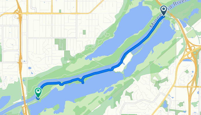
Black Dog Rd, Burnsville to Black Dog Rd, Burnsville
A cycling route starting in Bloomington, Minnesota, United States.
Overview
About this route
- 34 min
- Duration
- 6 km
- Distance
- 3 m
- Ascent
- 3 m
- Descent
- 10.4 km/h
- Avg. speed
- 218 m
- Max. altitude
Route photos


Route quality
Waytypes & surfaces along the route
Waytypes
Cycleway
5.8 km
(97 %)
Path
0.2 km
(3 %)
Surfaces
Paved
5.8 km
(97 %)
Asphalt
5.7 km
(96 %)
Concrete
0.1 km
(1 %)
Undefined
0.2 km
(3 %)
Continue with Bikemap
Use, edit, or download this cycling route
You would like to ride Black Dog Rd, Burnsville to Black Dog Rd, Burnsville or customize it for your own trip? Here is what you can do with this Bikemap route:
Free features
- Save this route as favorite or in collections
- Copy & plan your own version of this route
- Sync your route with Garmin or Wahoo
Premium features
Free trial for 3 days, or one-time payment. More about Bikemap Premium.
- Navigate this route on iOS & Android
- Export a GPX / KML file of this route
- Create your custom printout (try it for free)
- Download this route for offline navigation
Discover more Premium features.
Get Bikemap PremiumFrom our community
Other popular routes starting in Bloomington
 B2B000012 55420 > 55402 via 12th and Park
- Distance
- 21.4 km
- Ascent
- 23 m
- Descent
- 8 m
- Location
- Bloomington, Minnesota, United States
 Oakland Avenue South 8608, Minneapolis to Parklawn Ave & France Ave S, Edina
- Distance
- 10.4 km
- Ascent
- 13 m
- Descent
- 3 m
- Location
- Bloomington, Minnesota, United States
 B2B00113 55420 > 55415 via Chicago, 12th, and Park
- Distance
- 18.9 km
- Ascent
- 27 m
- Descent
- 16 m
- Location
- Bloomington, Minnesota, United States
 bike trail/road biking mix
- Distance
- 10.7 km
- Ascent
- 56 m
- Descent
- 53 m
- Location
- Bloomington, Minnesota, United States
 Hog Back Ridge Trail, Bloomington to Bluff Trail, Bloomington
- Distance
- 6.7 km
- Ascent
- 3 m
- Descent
- 6 m
- Location
- Bloomington, Minnesota, United States
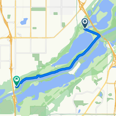
 Black Dog Rd, Burnsville to Black Dog Rd, Burnsville
- Distance
- 6 km
- Ascent
- 3 m
- Descent
- 3 m
- Location
- Bloomington, Minnesota, United States
 B2B00894 55437>55435 via Poplar Brg Rd, Xerxes
- Distance
- 7.2 km
- Ascent
- 46 m
- Descent
- 39 m
- Location
- Bloomington, Minnesota, United States
 494: Old Cedar Ave to Cypress Semiconductor
- Distance
- 1.6 km
- Ascent
- 0 m
- Descent
- 0 m
- Location
- Bloomington, Minnesota, United States
Open it in the app