
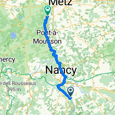
From Husseren-Wesserling to Metz
Bayon - Frouard
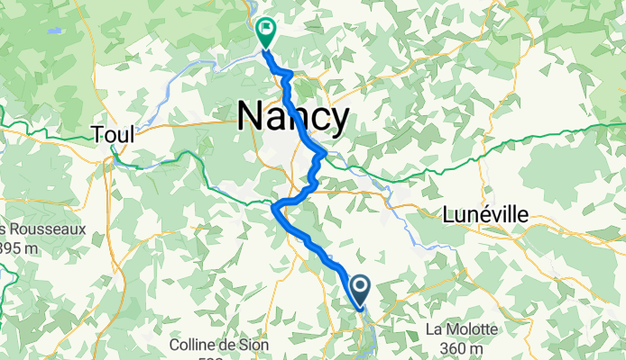
A cycling route starting in Bayon, Grand Est, France.
Overview
About this route
- 2 h 21 min
- Duration
- 44 km
- Distance
- 124 m
- Ascent
- 178 m
- Descent
- 18.7 km/h
- Avg. speed
- 263 m
- Max. altitude

Part of
From Husseren-Wesserling to Metz
4 stages
Route quality
Waytypes & surfaces along the route
Waytypes
Path
40.9 km
(93 %)
Quiet road
2.2 km
(5 %)
Surfaces
Paved
43.6 km
(99 %)
Unpaved
0.9 km
(2 %)
Asphalt
43.1 km
(98 %)
Concrete
0.4 km
(1 %)
Continue with Bikemap
Use, edit, or download this cycling route
You would like to ride Bayon - Frouard or customize it for your own trip? Here is what you can do with this Bikemap route:
Free features
- Save this route as favorite or in collections
- Copy & plan your own version of this route
- Sync your route with Garmin or Wahoo
Premium features
Free trial for 3 days, or one-time payment. More about Bikemap Premium.
- Navigate this route on iOS & Android
- Export a GPX / KML file of this route
- Create your custom printout (try it for free)
- Download this route for offline navigation
Discover more Premium features.
Get Bikemap PremiumFrom our community
Other popular routes starting in Bayon
 Af: Dag 03, Bayon - Marnay
- Distance
- 181.4 km
- Ascent
- 727 m
- Descent
- 785 m
- Location
- Bayon, Grand Est, France
 De Velle-sur-Moselle à Corny-sur-Moselle
- Distance
- 83.1 km
- Ascent
- 194 m
- Descent
- 254 m
- Location
- Bayon, Grand Est, France
 F-Beaune Brüssel-5
- Distance
- 156.2 km
- Ascent
- 683 m
- Descent
- 772 m
- Location
- Bayon, Grand Est, France
 11 - BAYON > VINCEY
- Distance
- 19.2 km
- Ascent
- 37 m
- Descent
- 8 m
- Location
- Bayon, Grand Est, France
 Saint Remimont - Toul
- Distance
- 45 km
- Ascent
- 136 m
- Descent
- 239 m
- Location
- Bayon, Grand Est, France
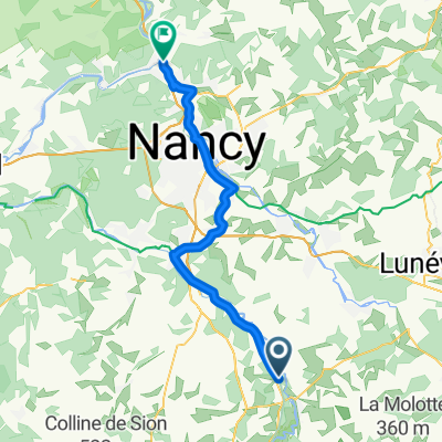 Bayon - Frouard
- Distance
- 44 km
- Ascent
- 124 m
- Descent
- 178 m
- Location
- Bayon, Grand Est, France
 Fietsvakantie, Trip 11
- Distance
- 81.1 km
- Ascent
- 416 m
- Descent
- 448 m
- Location
- Bayon, Grand Est, France
 Fietsvakantie, Trip 11
- Distance
- 82.4 km
- Ascent
- 470 m
- Descent
- 501 m
- Location
- Bayon, Grand Est, France
Open it in the app