
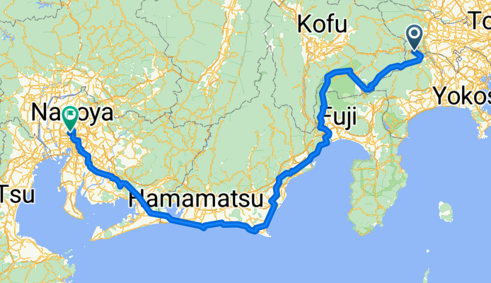
Sagamiko-Nagoya
A cycling route starting in Uenohara, Yamanashi, Japan.
Overview
About this route
- 28 h 38 min
- Duration
- 412.1 km
- Distance
- 7,207 m
- Ascent
- 7,379 m
- Descent
- 14.4 km/h
- Avg. speed
- 1,142 m
- Max. altitude

Continue with Bikemap
Use, edit, or download this cycling route
You would like to ride Sagamiko-Nagoya or customize it for your own trip? Here is what you can do with this Bikemap route:
Free features
- Save this route as favorite or in collections
- Copy & plan your own version of this route
- Split it into stages to create a multi-day tour
- Sync your route with Garmin or Wahoo
Premium features
Free trial for 3 days, or one-time payment. More about Bikemap Premium.
- Navigate this route on iOS & Android
- Export a GPX / KML file of this route
- Create your custom printout (try it for free)
- Download this route for offline navigation
Discover more Premium features.
Get Bikemap PremiumFrom our community
Other popular routes starting in Uenohara
 Sagamiko to home
- Distance
- 23.3 km
- Ascent
- 246 m
- Descent
- 297 m
- Location
- Uenohara, Yamanashi, Japan
 De Sagamihara a 1, Chiyoda City
- Distance
- 68 km
- Ascent
- 764 m
- Descent
- 948 m
- Location
- Uenohara, Yamanashi, Japan
 Sagamihara to 1, Yokohama
- Distance
- 49.8 km
- Ascent
- 277 m
- Descent
- 436 m
- Location
- Uenohara, Yamanashi, Japan
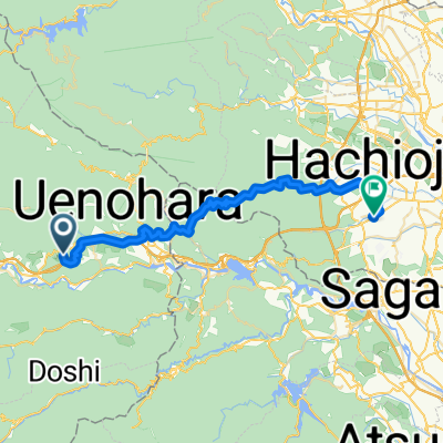
 檜原村へ東浅川町, 八王子市
- Distance
- 48.7 km
- Ascent
- 1,995 m
- Descent
- 2,508 m
- Location
- Uenohara, Yamanashi, Japan
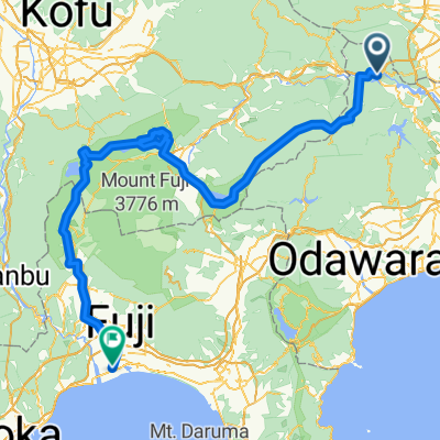 相模湖・富士五湖・朝霧高原
- Distance
- 155.1 km
- Ascent
- 3,464 m
- Descent
- 3,651 m
- Location
- Uenohara, Yamanashi, Japan
 FujiTrip-2AB
- Distance
- 72.6 km
- Ascent
- 1,640 m
- Descent
- 840 m
- Location
- Uenohara, Yamanashi, Japan
 2017 月夜見サイクルマラソン
- Distance
- 62.5 km
- Ascent
- 3,164 m
- Descent
- 3,166 m
- Location
- Uenohara, Yamanashi, Japan
 犬目, 上野原市へ東浅川町, 八王子市
- Distance
- 40.9 km
- Ascent
- 1,392 m
- Descent
- 1,707 m
- Location
- Uenohara, Yamanashi, Japan
Open it in the app