
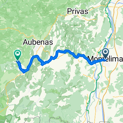
Overview
About this route
- 7 h 51 min
- Duration
- 148.7 km
- Distance
- 500 m
- Ascent
- 540 m
- Descent
- 18.9 km/h
- Avg. speed
- 87 m
- Max. altitude
Part of
Road to TdF
7 stages
Route quality
Waytypes & surfaces along the route
Waytypes
Quiet road
69.9 km
(47 %)
Cycleway
31.2 km
(21 %)
Surfaces
Paved
110 km
(74 %)
Asphalt
108.5 km
(73 %)
Concrete
1.5 km
(1 %)
Undefined
38.7 km
(26 %)
Continue with Bikemap
Use, edit, or download this cycling route
You would like to ride Clérieux - Mornas or customize it for your own trip? Here is what you can do with this Bikemap route:
Free features
- Save this route as favorite or in collections
- Copy & plan your own version of this route
- Split it into stages to create a multi-day tour
- Sync your route with Garmin or Wahoo
Premium features
Free trial for 3 days, or one-time payment. More about Bikemap Premium.
- Navigate this route on iOS & Android
- Export a GPX / KML file of this route
- Create your custom printout (try it for free)
- Download this route for offline navigation
Discover more Premium features.
Get Bikemap PremiumFrom our community
Other popular routes starting in Montélimar
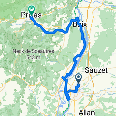 Monte nach Privas 110 km
- Distance
- 56.1 km
- Ascent
- 607 m
- Descent
- 405 m
- Location
- Montélimar, Auvergne-Rhône-Alpes, France
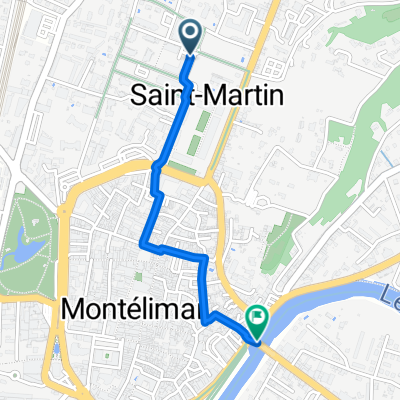 Chemin de la Manche bis to Boulevard du Fust Bis
- Distance
- 1.5 km
- Ascent
- 15 m
- Descent
- 71 m
- Location
- Montélimar, Auvergne-Rhône-Alpes, France
 Montélimar - Montfaucon
- Distance
- 67.6 km
- Ascent
- 162 m
- Descent
- 212 m
- Location
- Montélimar, Auvergne-Rhône-Alpes, France
 Montelimar (col Ardeche)
- Distance
- 55.7 km
- Ascent
- 840 m
- Descent
- 845 m
- Location
- Montélimar, Auvergne-Rhône-Alpes, France
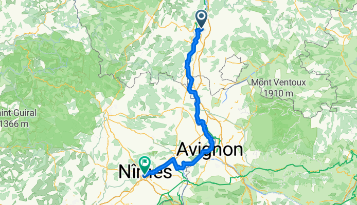
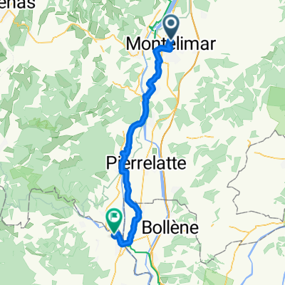
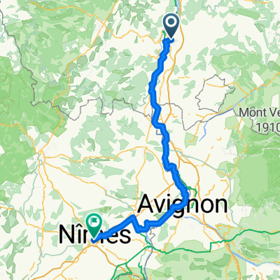 Clérieux - Mornas
- Distance
- 148.7 km
- Ascent
- 500 m
- Descent
- 540 m
- Location
- Montélimar, Auvergne-Rhône-Alpes, France
 De Montelimar Gare Routière à Le Mas d'Aval
- Distance
- 63.3 km
- Ascent
- 1,217 m
- Descent
- 878 m
- Location
- Montélimar, Auvergne-Rhône-Alpes, France
 montelimar to port st esprit
- Distance
- 50.1 km
- Ascent
- 153 m
- Descent
- 160 m
- Location
- Montélimar, Auvergne-Rhône-Alpes, France
 C'est beau le Niger (provençal) à vélo 2016
- Distance
- 365.8 km
- Ascent
- 2,835 m
- Descent
- 2,886 m
- Location
- Montélimar, Auvergne-Rhône-Alpes, France
Open it in the app