
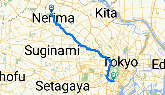
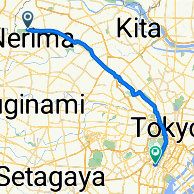
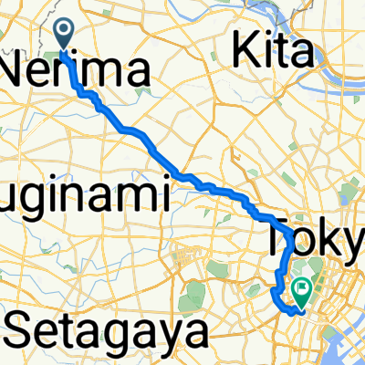
板橋区へ西新橋1丁目, 港区
A cycling route starting in Wako, Saitama, Japan.
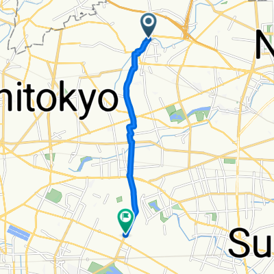
Overview
About this route
- 1 h 34 min
- Duration
- 21.2 km
- Distance
- 84 m
- Ascent
- 139 m
- Descent
- 13.5 km/h
- Avg. speed
- 64 m
- Max. altitude
Route quality
Waytypes & surfaces along the route
Waytypes
Quiet road
15.2 km
(72 %)
Road
3 km
(14 %)
Surfaces
Paved
9.5 km
(45 %)
Paved (undefined)
5.7 km
(27 %)
Asphalt
3.8 km
(18 %)
Undefined
11.6 km
(55 %)
Continue with Bikemap
Use, edit, or download this cycling route
You would like to ride 板橋区へ西新橋1丁目, 港区 or customize it for your own trip? Here is what you can do with this Bikemap route:
Free features
- Save this route as favorite or in collections
- Copy & plan your own version of this route
- Sync your route with Garmin or Wahoo
Premium features
Free trial for 3 days, or one-time payment. More about Bikemap Premium.
- Navigate this route on iOS & Android
- Export a GPX / KML file of this route
- Create your custom printout (try it for free)
- Download this route for offline navigation
Discover more Premium features.
Get Bikemap PremiumFrom our community
Other popular routes starting in Wako
 赤塚新町3丁目, 板橋区へ西新橋1丁目, 港区
- Distance
- 19.7 km
- Ascent
- 61 m
- Descent
- 92 m
- Location
- Wako, Saitama, Japan
 赤塚新町3丁目, 板橋区へ西新橋1丁目, 港区
- Distance
- 19.7 km
- Ascent
- 57 m
- Descent
- 87 m
- Location
- Wako, Saitama, Japan
 練馬~東京ビッグサイト
- Distance
- 23.3 km
- Ascent
- 287 m
- Descent
- 305 m
- Location
- Wako, Saitama, Japan
 板橋区へ西新橋1丁目, 港区
- Distance
- 21.2 km
- Ascent
- 84 m
- Descent
- 139 m
- Location
- Wako, Saitama, Japan
 大泉学園町1丁目, 練馬区へ吉祥寺東町1丁目, 武蔵野市
- Distance
- 6.4 km
- Ascent
- 25 m
- Descent
- 10 m
- Location
- Wako, Saitama, Japan
 1丁目 16, 練馬区 to 1丁目 16, 練馬区
- Distance
- 93 km
- Ascent
- 343 m
- Descent
- 344 m
- Location
- Wako, Saitama, Japan
 練馬~NEC玉川
- Distance
- 22.6 km
- Ascent
- 139 m
- Descent
- 175 m
- Location
- Wako, Saitama, Japan
 27-5, Shakujiimachi 3-Chōme, Nerima to 都道444号, Nerima
- Distance
- 0.8 km
- Ascent
- 0 m
- Descent
- 3 m
- Location
- Wako, Saitama, Japan
Open it in the app