
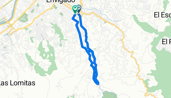
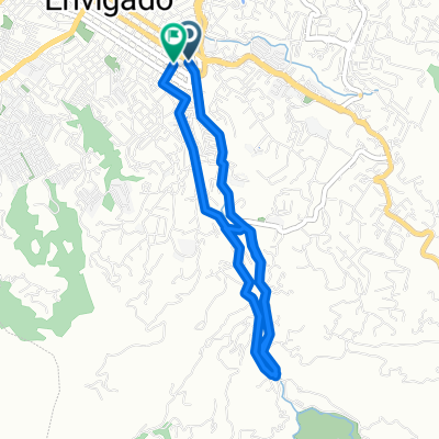
De Calle Sur 32-43 a Calle Sur
A cycling route starting in Envigado, Antioquia, Colombia.
Overview
About this route
- 47 min
- Duration
- 12.4 km
- Distance
- 346 m
- Ascent
- 344 m
- Descent
- 15.9 km/h
- Avg. speed
- 1,753 m
- Max. altitude

Route quality
Waytypes & surfaces along the route
Waytypes
Quiet road
10.8 km
(87 %)
Road
1.4 km
(11 %)
Undefined
0.2 km
(2 %)
Surfaces
Paved
12.1 km
(98 %)
Asphalt
12.1 km
(98 %)
Undefined
0.2 km
(2 %)
Continue with Bikemap
Use, edit, or download this cycling route
You would like to ride De Calle Sur 32-43 a Calle Sur or customize it for your own trip? Here is what you can do with this Bikemap route:
Free features
- Save this route as favorite or in collections
- Copy & plan your own version of this route
- Sync your route with Garmin or Wahoo
Premium features
Free trial for 3 days, or one-time payment. More about Bikemap Premium.
- Navigate this route on iOS & Android
- Export a GPX / KML file of this route
- Create your custom printout (try it for free)
- Download this route for offline navigation
Discover more Premium features.
Get Bikemap PremiumFrom our community
Other popular routes starting in Envigado
 Circuito Transversales + Chuscalito
- Distance
- 13 km
- Ascent
- 366 m
- Descent
- 366 m
- Location
- Envigado, Antioquia, Colombia
 De Envigado a Calle 40e Sur 29-48, Envigado
- Distance
- 27.8 km
- Ascent
- 433 m
- Descent
- 54 m
- Location
- Envigado, Antioquia, Colombia
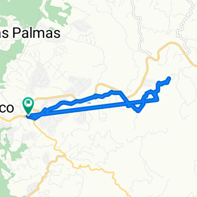
 PM Catedral
- Distance
- 7.4 km
- Ascent
- 829 m
- Descent
- 87 m
- Location
- Envigado, Antioquia, Colombia
 De Calle Sur 32-43 a Calle Sur
- Distance
- 12.4 km
- Ascent
- 346 m
- Descent
- 344 m
- Location
- Envigado, Antioquia, Colombia
 12 de diciembre - Alto de las palmas
- Distance
- 17.5 km
- Ascent
- 349 m
- Descent
- 364 m
- Location
- Envigado, Antioquia, Colombia
 Envigado - Abejorral - Envigado
- Distance
- 187.9 km
- Ascent
- 3,418 m
- Descent
- 3,418 m
- Location
- Envigado, Antioquia, Colombia
 Catedral En Luna Llena
- Distance
- 7.7 km
- Ascent
- 597 m
- Descent
- 111 m
- Location
- Envigado, Antioquia, Colombia
 Truchera Y Charco Azul
- Distance
- 12.1 km
- Ascent
- 374 m
- Descent
- 377 m
- Location
- Envigado, Antioquia, Colombia
Open it in the app