

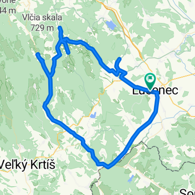
LC Tuhár Tomášovce
A cycling route starting in Lučenec, Banská Bystrica Region, Slovakia.
Overview
About this route
7.11.2025 2:23
- 3 h 8 min
- Duration
- 55.6 km
- Distance
- 554 m
- Ascent
- 556 m
- Descent
- 17.7 km/h
- Avg. speed
- 399 m
- Max. altitude

Route quality
Waytypes & surfaces along the route
Waytypes
Road
42.3 km
(76 %)
Quiet road
3.9 km
(7 %)
Surfaces
Paved
25.6 km
(46 %)
Asphalt
25.6 km
(46 %)
Undefined
30 km
(54 %)
Continue with Bikemap
Use, edit, or download this cycling route
You would like to ride LC Tuhár Tomášovce or customize it for your own trip? Here is what you can do with this Bikemap route:
Free features
- Save this route as favorite or in collections
- Copy & plan your own version of this route
- Sync your route with Garmin or Wahoo
Premium features
Free trial for 3 days, or one-time payment. More about Bikemap Premium.
- Navigate this route on iOS & Android
- Export a GPX / KML file of this route
- Create your custom printout (try it for free)
- Download this route for offline navigation
Discover more Premium features.
Get Bikemap PremiumFrom our community
Other popular routes starting in Lučenec
 LC Dolný Tisovník Abelová
- Distance
- 100.5 km
- Ascent
- 1,045 m
- Descent
- 1,045 m
- Location
- Lučenec, Banská Bystrica Region, Slovakia
 Route in Lučenec
- Distance
- 85.9 km
- Ascent
- 582 m
- Descent
- 585 m
- Location
- Lučenec, Banská Bystrica Region, Slovakia
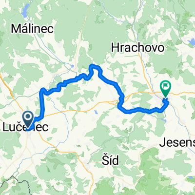
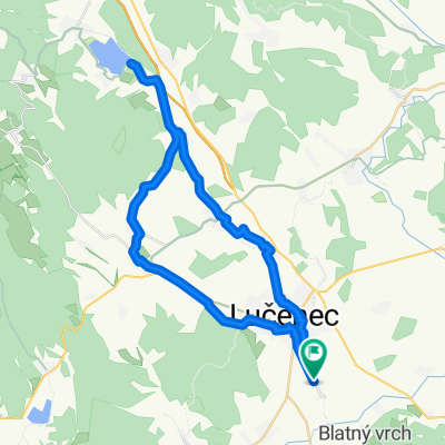 Mikušovce do Ružiná
- Distance
- 43 km
- Ascent
- 363 m
- Descent
- 363 m
- Location
- Lučenec, Banská Bystrica Region, Slovakia
 Gregorova Vieska do Z. Nejedlého
- Distance
- 27.5 km
- Ascent
- 217 m
- Descent
- 350 m
- Location
- Lučenec, Banská Bystrica Region, Slovakia
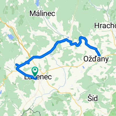
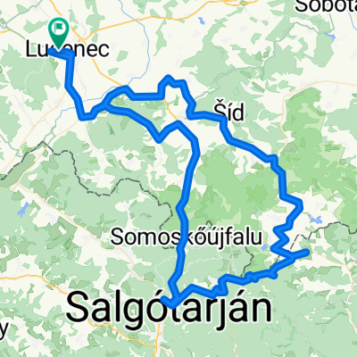 LC Cered Salgotarján
- Distance
- 120.6 km
- Ascent
- 1,313 m
- Descent
- 1,314 m
- Location
- Lučenec, Banská Bystrica Region, Slovakia
 Tomáša Garrigue Masaryka do B. Bartóka
- Distance
- 48.2 km
- Ascent
- 477 m
- Descent
- 462 m
- Location
- Lučenec, Banská Bystrica Region, Slovakia
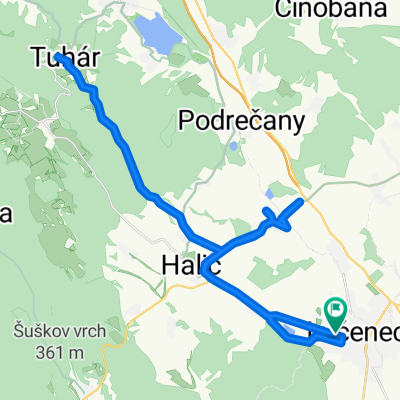 LC Tuhár Tomášovce
- Distance
- 55.6 km
- Ascent
- 554 m
- Descent
- 556 m
- Location
- Lučenec, Banská Bystrica Region, Slovakia
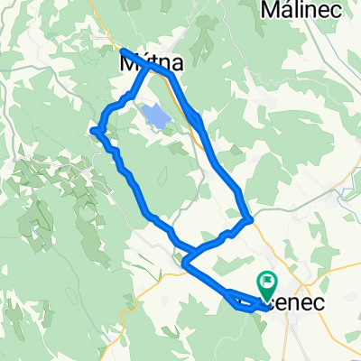 LC Divín Diaľnica Mýtna Halier
- Distance
- 80.6 km
- Ascent
- 789 m
- Descent
- 789 m
- Location
- Lučenec, Banská Bystrica Region, Slovakia
Open it in the app