
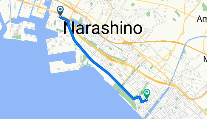
浜町, 船橋市へ打瀬1丁目, 千葉市
A cycling route starting in Funabashi, Chiba, Japan.
Overview
About this route
- 1 h 25 min
- Duration
- 7.6 km
- Distance
- 7 m
- Ascent
- 7 m
- Descent
- 5.3 km/h
- Avg. speed
- 10 m
- Max. altitude

Continue with Bikemap
Use, edit, or download this cycling route
You would like to ride 浜町, 船橋市へ打瀬1丁目, 千葉市 or customize it for your own trip? Here is what you can do with this Bikemap route:
Free features
- Save this route as favorite or in collections
- Copy & plan your own version of this route
- Sync your route with Garmin or Wahoo
Premium features
Free trial for 3 days, or one-time payment. More about Bikemap Premium.
- Navigate this route on iOS & Android
- Export a GPX / KML file of this route
- Create your custom printout (try it for free)
- Download this route for offline navigation
Discover more Premium features.
Get Bikemap PremiumFrom our community
Other popular routes starting in Funabashi
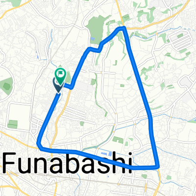 Maekaizukacho, Funabashi to Maekaizukacho, Funabashi
- Distance
- 9.7 km
- Ascent
- 69 m
- Descent
- 74 m
- Location
- Funabashi, Chiba, Japan
 麻綿原ルート
- Distance
- 76.9 km
- Ascent
- 471 m
- Descent
- 166 m
- Location
- Funabashi, Chiba, Japan
 Home-Lalaport Funabashi
- Distance
- 8.2 km
- Ascent
- 28 m
- Descent
- 46 m
- Location
- Funabashi, Chiba, Japan
 Lower Lake Tega Ride
- Distance
- 50.9 km
- Ascent
- 119 m
- Descent
- 120 m
- Location
- Funabashi, Chiba, Japan
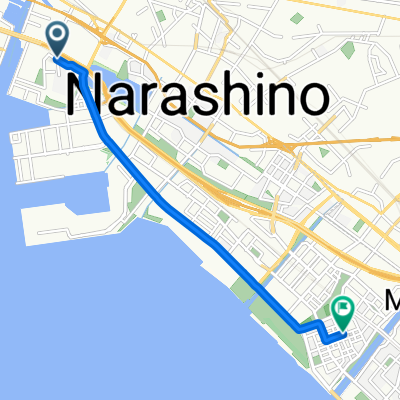 浜町, 船橋市へ打瀬1丁目, 千葉市
- Distance
- 7.6 km
- Ascent
- 7 m
- Descent
- 7 m
- Location
- Funabashi, Chiba, Japan
 Arakawa River Ride
- Distance
- 84.6 km
- Ascent
- 202 m
- Descent
- 224 m
- Location
- Funabashi, Chiba, Japan
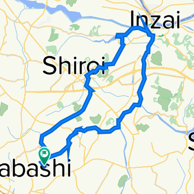
 丁寧な印旛沼サイクリング
- Distance
- 47.9 km
- Ascent
- 119 m
- Descent
- 118 m
- Location
- Funabashi, Chiba, Japan
 Yatsu Higata Tour
- Distance
- 20 km
- Ascent
- 45 m
- Descent
- 46 m
- Location
- Funabashi, Chiba, Japan
Open it in the app