
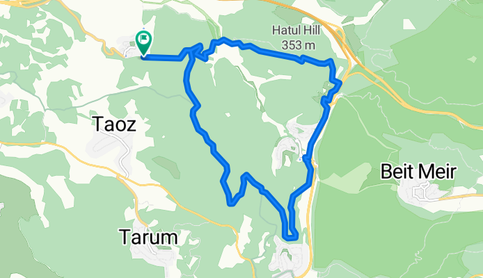
Israel Track, Latrun to Israel Track, Latrun
- 16.1 km
- 322 m
- 320 m
- Bayt Liqyā, West Bank, Palestine
A cycling route starting in Bayt Liqyā, West Bank, Palestine.
Overview
created this 5 months ago
Route quality
Track
13.8 km
85 %
Quiet road
1 km
6 %
Unpaved
10.6 km
(65 %)
Gravel
8.6 km
53 %
Unpaved (undefined)
1.6 km
10 %
Continue with Bikemap
You would like to ride Neve Shalom to Messilat Zion v.v. Track or customize it for your own trip? Here is what you can do with this Bikemap route:
Free trial for 3 days, or one-time payment. More about Bikemap Premium.
Discover more Premium features.
Get Bikemap PremiumFrom our community
Open it in the app


