
Kufstein - Trieste
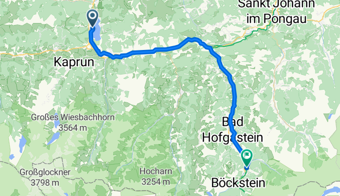
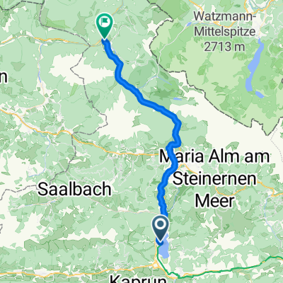
Von Zell am See bis Bad Gastein
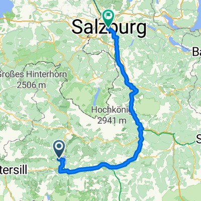
A cycling route starting in Zell am See, Salzburg, Austria.
Overview
About this route
- 3 h 15 min
- Duration
- 51 km
- Distance
- 988 m
- Ascent
- 721 m
- Descent
- 15.7 km/h
- Avg. speed
- 1,039 m
- Max. altitude

Part of
Kufstein - Trieste
12 stages
Route quality
Waytypes & surfaces along the route
Waytypes
Quiet road
22.9 km
(45 %)
Path
13.8 km
(27 %)
Surfaces
Paved
42.8 km
(84 %)
Unpaved
4.1 km
(8 %)
Asphalt
42.3 km
(83 %)
Loose gravel
2.5 km
(5 %)
Continue with Bikemap
Use, edit, or download this cycling route
You would like to ride Von Zell am See bis Bad Gastein or customize it for your own trip? Here is what you can do with this Bikemap route:
Free features
- Save this route as favorite or in collections
- Copy & plan your own version of this route
- Sync your route with Garmin or Wahoo
Premium features
Free trial for 3 days, or one-time payment. More about Bikemap Premium.
- Navigate this route on iOS & Android
- Export a GPX / KML file of this route
- Create your custom printout (try it for free)
- Download this route for offline navigation
Discover more Premium features.
Get Bikemap PremiumFrom our community
Other popular routes starting in Zell am See
 From Zell am See to Lofer
- Distance
- 40.3 km
- Ascent
- 574 m
- Descent
- 713 m
- Location
- Zell am See, Salzburg, Austria
 Wald im Pinzgau - Saalfelden am Steinernen Meer
- Distance
- 40.5 km
- Ascent
- 579 m
- Descent
- 721 m
- Location
- Zell am See, Salzburg, Austria
 Esplanade, Zell am See nach Schlaming, Pfarrwerfen
- Distance
- 64.9 km
- Ascent
- 769 m
- Descent
- 893 m
- Location
- Zell am See, Salzburg, Austria
 Brucker B, Zell am See to Rupertiweg, Lend
- Distance
- 18.2 km
- Ascent
- 182 m
- Descent
- 213 m
- Location
- Zell am See, Salzburg, Austria
 Versuch 10
- Distance
- 91.2 km
- Ascent
- 814 m
- Descent
- 814 m
- Location
- Zell am See, Salzburg, Austria
 Itálie 1999 - 3. etapa (31.7.1999)
- Distance
- 79 km
- Ascent
- 2,608 m
- Descent
- 2,414 m
- Location
- Zell am See, Salzburg, Austria
 Schmittenstraße do Rathausplatz
- Distance
- 112.9 km
- Ascent
- 1,852 m
- Descent
- 2,350 m
- Location
- Zell am See, Salzburg, Austria
 Rupertiweg do Franz-Josef-Kai
- Distance
- 114.4 km
- Ascent
- 690 m
- Descent
- 1,243 m
- Location
- Zell am See, Salzburg, Austria
Open it in the app