

Rivage, Stavelot nach Rivage, Stavelot
A cycling route starting in Stavelot, Wallonia, Belgium.
Overview
About this route
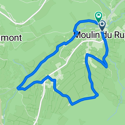
Embark on a thrilling 36.4 km cycling adventure through stunning landscapes! Begin your journey with a gentle ascent of 453 meters, gradually building momentum as you navigate through varied terrain. Feel the rush with a descent of 462 meters, offering exhilarating views and a true test of your cycling skills. The highest point awaits at 511 meters, rewarding you with breathtaking vistas. This route is perfect for cyclists seeking a mix of challenge and beauty, promising an unforgettable ride!
AI generated
- 2 h 6 min
- Duration
- 36.4 km
- Distance
- 453 m
- Ascent
- 462 m
- Descent
- 17.3 km/h
- Avg. speed
- 512 m
- Max. altitude

Route quality
Waytypes & surfaces along the route
Waytypes
Cycleway
16 km
(44 %)
Road
11.6 km
(32 %)
Surfaces
Paved
31.3 km
(86 %)
Asphalt
31.3 km
(86 %)
Undefined
5.1 km
(14 %)
Continue with Bikemap
Use, edit, or download this cycling route
You would like to ride Rivage, Stavelot nach Rivage, Stavelot or customize it for your own trip? Here is what you can do with this Bikemap route:
Free features
- Save this route as favorite or in collections
- Copy & plan your own version of this route
- Sync your route with Garmin or Wahoo
Premium features
Free trial for 3 days, or one-time payment. More about Bikemap Premium.
- Navigate this route on iOS & Android
- Export a GPX / KML file of this route
- Create your custom printout (try it for free)
- Download this route for offline navigation
Discover more Premium features.
Get Bikemap PremiumFrom our community
Other popular routes starting in Stavelot
 Ardennen 100km
- Distance
- 99.5 km
- Ascent
- 1,638 m
- Descent
- 1,638 m
- Location
- Stavelot, Wallonia, Belgium
 Ardennen 95
- Distance
- 106.1 km
- Ascent
- 1,606 m
- Descent
- 1,606 m
- Location
- Stavelot, Wallonia, Belgium
 Stavelot 95km
- Distance
- 92.8 km
- Ascent
- 1,804 m
- Descent
- 1,816 m
- Location
- Stavelot, Wallonia, Belgium
 Stavelot - Stolberg, Rheinland
- Distance
- 57.4 km
- Ascent
- 726 m
- Descent
- 744 m
- Location
- Stavelot, Wallonia, Belgium
 La Gleize | P6 Moulin du Ruy - Heilrimont - Roanne
- Distance
- 6.5 km
- Ascent
- 186 m
- Descent
- 185 m
- Location
- Stavelot, Wallonia, Belgium
 Lange Route over 4 beklimmingen
- Distance
- 105.6 km
- Ascent
- 1,353 m
- Descent
- 1,353 m
- Location
- Stavelot, Wallonia, Belgium
 Start Stavelot
- Distance
- 32.9 km
- Ascent
- 673 m
- Descent
- 673 m
- Location
- Stavelot, Wallonia, Belgium
 Rivage, Stavelot nach Rivage, Stavelot
- Distance
- 36.4 km
- Ascent
- 453 m
- Descent
- 462 m
- Location
- Stavelot, Wallonia, Belgium
Open it in the app