
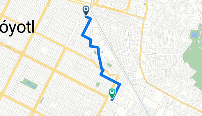
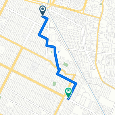
Futbol cancha 3
A cycling route starting in Polígonos, State of Mexico, Mexico.
Overview
About this route
- 9 min
- Duration
- 3.4 km
- Distance
- 0 m
- Ascent
- 0 m
- Descent
- 22.5 km/h
- Avg. speed
- 2,238 m
- Max. altitude
Route quality
Waytypes & surfaces along the route
Waytypes
Quiet road
3.1 km
(92 %)
Road
0.2 km
(6 %)
Undefined
0.1 km
(2 %)
Surfaces
Paved
3.4 km
(100 %)
Asphalt
3.4 km
(100 %)
Continue with Bikemap
Use, edit, or download this cycling route
You would like to ride Futbol cancha 3 or customize it for your own trip? Here is what you can do with this Bikemap route:
Free features
- Save this route as favorite or in collections
- Copy & plan your own version of this route
- Sync your route with Garmin or Wahoo
Premium features
Free trial for 3 days, or one-time payment. More about Bikemap Premium.
- Navigate this route on iOS & Android
- Export a GPX / KML file of this route
- Create your custom printout (try it for free)
- Download this route for offline navigation
Discover more Premium features.
Get Bikemap PremiumFrom our community
Other popular routes starting in Polígonos
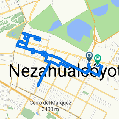 De 7 Leguas 399-441, Nezahualcóyotl a La Texanita 421, Nezahualcóyotl
- Distance
- 25.5 km
- Ascent
- 129 m
- Descent
- 120 m
- Location
- Polígonos, State of Mexico, Mexico
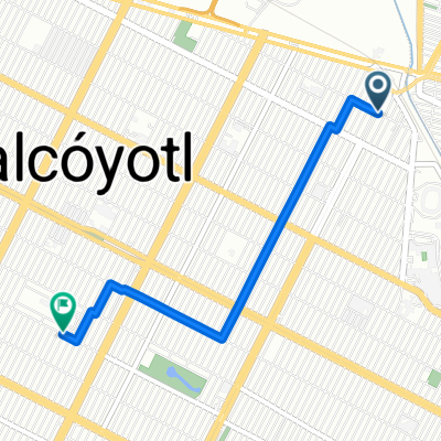
 De Mariquita Linda 306, Nezahualcóyotl a Santa Isabel 171, Nezahualcóyotl
- Distance
- 3.9 km
- Ascent
- 22 m
- Descent
- 28 m
- Location
- Polígonos, State of Mexico, Mexico
 De La Malagueña 339, Benito Juarez a Circuito Alameda Oriente, Ciudad de México
- Distance
- 10.3 km
- Ascent
- 8 m
- Descent
- 12 m
- Location
- Polígonos, State of Mexico, Mexico
 De Talabarteros, Chimalhuacán a Hacienda El Nogal 145, Cuautitlán
- Distance
- 56.2 km
- Ascent
- 83 m
- Descent
- 81 m
- Location
- Polígonos, State of Mexico, Mexico
 De 2a. Cerrada de Asturias 1a, Chimalhuacán a Canela 150 A, Ciudad de México
- Distance
- 18 km
- Ascent
- 17 m
- Descent
- 18 m
- Location
- Polígonos, State of Mexico, Mexico
 Futbol cancha 3
- Distance
- 3.4 km
- Ascent
- 0 m
- Descent
- 0 m
- Location
- Polígonos, State of Mexico, Mexico
 De Benito Juárez, Nezahualcóyotl a Santa Isabel 161, Nezahualcóyotl
- Distance
- 2.9 km
- Ascent
- 0 m
- Descent
- 0 m
- Location
- Polígonos, State of Mexico, Mexico
 mi chula a casa
- Distance
- 4.1 km
- Ascent
- 0 m
- Descent
- 3 m
- Location
- Polígonos, State of Mexico, Mexico
Open it in the app