
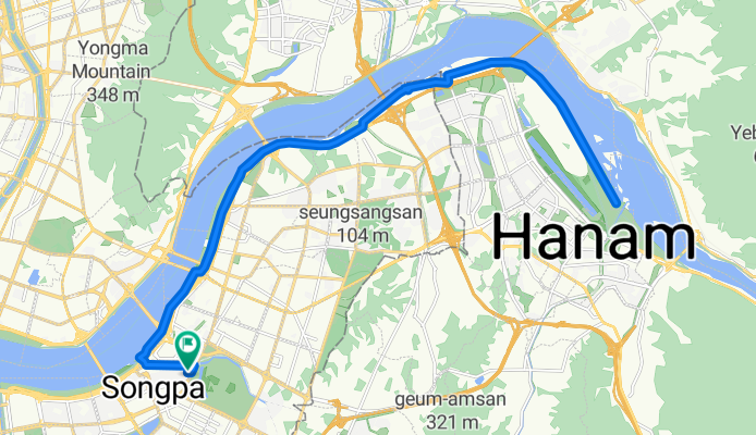
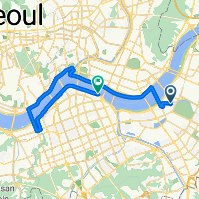
신천동, 서울특별시에서 신천동, 서울특별시까지
A cycling route starting in Hanam, Gyeonggi-do, South Korea.
Overview
About this route
Embark on an exhilarating 35.1 km cycling adventure that promises both challenge and beauty. Starting from a picturesque trailhead, you'll glide over varied terrains that keep the ride dynamic and engaging. As you pedal through lush landscapes, you'll ascend a modest 158 meters, rewarding your efforts with breathtaking views.
Prepare for a thrilling descent of 164 meters, where the wind rushes past as you conquer the downhill stretch. The route peaks at a maximum elevation of 60 meters, offering a perfect balance of challenge and scenic delight.
Whether you're a seasoned cyclist or a weekend explorer, this route caters to your passion for cycling, blending natural beauty with an invigorating workout. Get ready for an unforgettable ride!
AI generated
- 2 h 19 min
- Duration
- 35.1 km
- Distance
- 159 m
- Ascent
- 164 m
- Descent
- 15.1 km/h
- Avg. speed
- 60 m
- Max. altitude

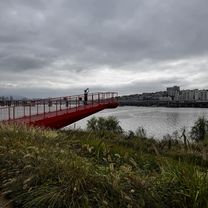
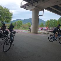
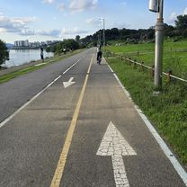
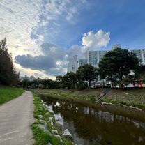
Route photos


Route quality
Waytypes & surfaces along the route
Waytypes
Cycleway
32.7 km
(93 %)
Quiet road
1.4 km
(4 %)
Surfaces
Paved
33 km
(94 %)
Asphalt
22.1 km
(63 %)
Concrete
10.9 km
(31 %)
Undefined
2.1 km
(6 %)
Continue with Bikemap
Use, edit, or download this cycling route
You would like to ride 신천동, 서울특별시에서 신천동, 서울특별시까지 or customize it for your own trip? Here is what you can do with this Bikemap route:
Free features
- Save this route as favorite or in collections
- Copy & plan your own version of this route
- Sync your route with Garmin or Wahoo
Premium features
Free trial for 3 days, or one-time payment. More about Bikemap Premium.
- Navigate this route on iOS & Android
- Export a GPX / KML file of this route
- Create your custom printout (try it for free)
- Download this route for offline navigation
Discover more Premium features.
Get Bikemap PremiumFrom our community
Other popular routes starting in Hanam
 신천동, 서울특별시에서 신천동, 서울특별시까지
- Distance
- 28.4 km
- Ascent
- 190 m
- Descent
- 222 m
- Location
- Hanam, Gyeonggi-do, South Korea
 신천동, 서울특별시에서 신천동, 서울특별시까지
- Distance
- 35.1 km
- Ascent
- 159 m
- Descent
- 164 m
- Location
- Hanam, Gyeonggi-do, South Korea
 반포 라이딩
- Distance
- 25.5 km
- Ascent
- 80 m
- Descent
- 66 m
- Location
- Hanam, Gyeonggi-do, South Korea
 미사동 3-23 ~ 미사동 567-4
- Distance
- 8.5 km
- Ascent
- 44 m
- Descent
- 38 m
- Location
- Hanam, Gyeonggi-do, South Korea
![Ph0]에서 경로양서면](https://media.bikemap.net/routes/17638240/gallery/thumbs/8494bba0-b649-4e06-920a-fa8b786083ac.jpg.208x208_q80_crop.jpg) Ph0]에서 경로양서면
Ph0]에서 경로양서면- Distance
- 35.1 km
- Ascent
- 143 m
- Descent
- 160 m
- Location
- Hanam, Gyeonggi-do, South Korea
 인덕원 팔당
- Distance
- 47.1 km
- Ascent
- 274 m
- Descent
- 270 m
- Location
- Hanam, Gyeonggi-do, South Korea
 신천동, 서울특별시에서 올림픽대로, 서울특별시까지
- Distance
- 23.5 km
- Ascent
- 205 m
- Descent
- 226 m
- Location
- Hanam, Gyeonggi-do, South Korea
 창우동, 하남시에서 덕풍동, 하남시까지
- Distance
- 5.7 km
- Ascent
- 109 m
- Descent
- 110 m
- Location
- Hanam, Gyeonggi-do, South Korea
Open it in the app