
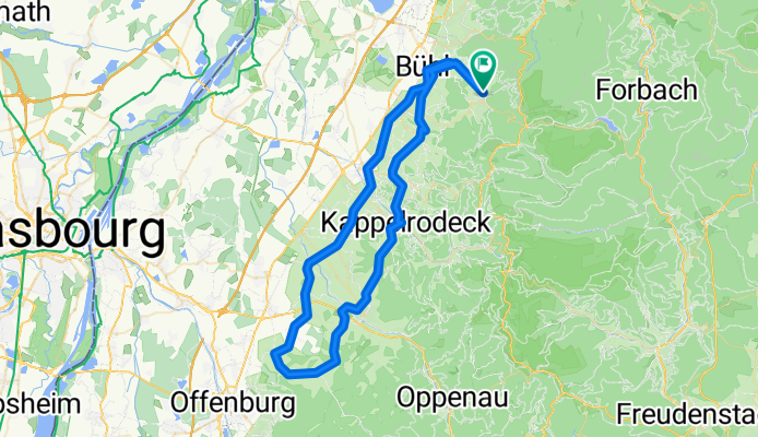
Badner Obst und Weinland Tour
A cycling route starting in Bühlertal, Baden-Wurttemberg, Germany.
Overview
About this route
- -:--
- Duration
- 73.2 km
- Distance
- 880 m
- Ascent
- 968 m
- Descent
- ---
- Avg. speed
- 369 m
- Max. altitude

Route quality
Waytypes & surfaces along the route
Waytypes
Road
39.1 km
(53 %)
Busy road
17.5 km
(24 %)
Surfaces
Paved
59.8 km
(82 %)
Unpaved
0.5 km
(<1 %)
Asphalt
59.5 km
(81 %)
Ground
0.3 km
(<1 %)
Continue with Bikemap
Use, edit, or download this cycling route
You would like to ride Badner Obst und Weinland Tour or customize it for your own trip? Here is what you can do with this Bikemap route:
Free features
- Save this route as favorite or in collections
- Copy & plan your own version of this route
- Sync your route with Garmin or Wahoo
Premium features
Free trial for 3 days, or one-time payment. More about Bikemap Premium.
- Navigate this route on iOS & Android
- Export a GPX / KML file of this route
- Create your custom printout (try it for free)
- Download this route for offline navigation
Discover more Premium features.
Get Bikemap PremiumFrom our community
Other popular routes starting in Bühlertal
 Bühlertäler Gebirgstour / Falkenfels Bühlertal
- Distance
- 94.1 km
- Ascent
- 2,600 m
- Descent
- 2,307 m
- Location
- Bühlertal, Baden-Wurttemberg, Germany
 Bühlertal-Scherrhof-Bütthof-Bühlertal
- Distance
- 32 km
- Ascent
- 1,302 m
- Descent
- 1,314 m
- Location
- Bühlertal, Baden-Wurttemberg, Germany
 Permanente Bühlertal-Rheintal Tour
- Distance
- 69.8 km
- Ascent
- 290 m
- Descent
- 404 m
- Location
- Bühlertal, Baden-Wurttemberg, Germany
 Mountainbiketour 005 mit 33Km und 950Hm
- Distance
- 32.1 km
- Ascent
- 868 m
- Descent
- 868 m
- Location
- Bühlertal, Baden-Wurttemberg, Germany
 Drei Täler Tour
- Distance
- 74.9 km
- Ascent
- 2,435 m
- Descent
- 2,342 m
- Location
- Bühlertal, Baden-Wurttemberg, Germany
 Schwimmbad Bühlertal - Hornisgrinde Rundweg
- Distance
- 44.4 km
- Ascent
- 1,131 m
- Descent
- 1,128 m
- Location
- Bühlertal, Baden-Wurttemberg, Germany
 3 Stunden Strecke
- Distance
- 36.5 km
- Ascent
- 958 m
- Descent
- 958 m
- Location
- Bühlertal, Baden-Wurttemberg, Germany
 Von Bühlertal bis Bundenthal
- Distance
- 145.1 km
- Ascent
- 1,902 m
- Descent
- 2,204 m
- Location
- Bühlertal, Baden-Wurttemberg, Germany
Open it in the app