
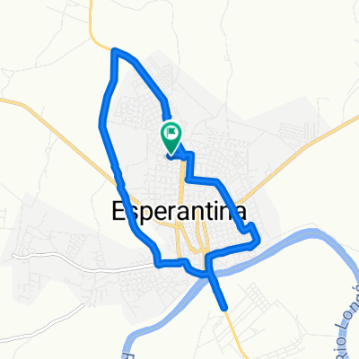
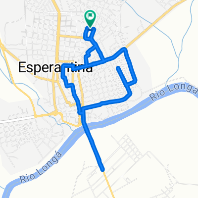
Esperantina a Esperantina
A cycling route starting in Esperantina, Piauí, Brazil.
Overview
About this route
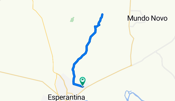
Embark on a scenic 21.3-kilometer cycling adventure through rolling landscapes and charming countryside. The ride begins with a gentle climb of 290 meters, followed by a thrilling descent of 293 meters, culminating in a maximum elevation of 116 meters. This route offers a perfect blend of elevation changes, providing both challenge and enjoyment for cyclists of all levels. Whether you're exploring local trails or seeking a new route, this journey promises an exhilarating experience.
AI generated
- 1 h 34 min
- Duration
- 21.3 km
- Distance
- 290 m
- Ascent
- 293 m
- Descent
- 13.6 km/h
- Avg. speed
- 117 m
- Max. altitude
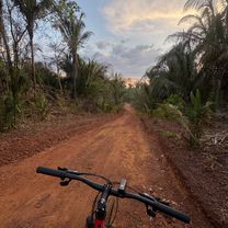
Route photos


Route quality
Waytypes & surfaces along the route
Waytypes
Quiet road
16.9 km
(79 %)
Track
4.5 km
(21 %)
Continue with Bikemap
Use, edit, or download this cycling route
You would like to ride Esperantina a Esperantina or customize it for your own trip? Here is what you can do with this Bikemap route:
Free features
- Save this route as favorite or in collections
- Copy & plan your own version of this route
- Sync your route with Garmin or Wahoo
Premium features
Free trial for 3 days, or one-time payment. More about Bikemap Premium.
- Navigate this route on iOS & Android
- Export a GPX / KML file of this route
- Create your custom printout (try it for free)
- Download this route for offline navigation
Discover more Premium features.
Get Bikemap PremiumFrom our community
Other popular routes starting in Esperantina
 Esperantina a Esperantina
- Distance
- 25.6 km
- Ascent
- 169 m
- Descent
- 174 m
- Location
- Esperantina, Piauí, Brazil
 Easy ride in Esperantina
- Distance
- 13.7 km
- Ascent
- 83 m
- Descent
- 103 m
- Location
- Esperantina, Piauí, Brazil
 Esperantina a Rua Abraão Gomes, Esperantina
- Distance
- 3.2 km
- Ascent
- 30 m
- Descent
- 31 m
- Location
- Esperantina, Piauí, Brazil
 -3.884, -42.217 a -3.903, -42.232
- Distance
- 13.5 km
- Ascent
- 98 m
- Descent
- 92 m
- Location
- Esperantina, Piauí, Brazil
 De Rua Sebastião Alves Machado 1579 a Rua Édison Chaves 1656
- Distance
- 9.3 km
- Ascent
- 89 m
- Descent
- 91 m
- Location
- Esperantina, Piauí, Brazil
 Esperantina a Esperantina
- Distance
- 21.3 km
- Ascent
- 290 m
- Descent
- 293 m
- Location
- Esperantina, Piauí, Brazil
 Avenida Ministro Petrônio Portela, Esperantina a Esperantina
- Distance
- 4 km
- Ascent
- 26 m
- Descent
- 51 m
- Location
- Esperantina, Piauí, Brazil
 Esperantina a Esperantina
- Distance
- 16.6 km
- Ascent
- 84 m
- Descent
- 88 m
- Location
- Esperantina, Piauí, Brazil
Open it in the app