
De Pachuca de Soto a Zacatlán
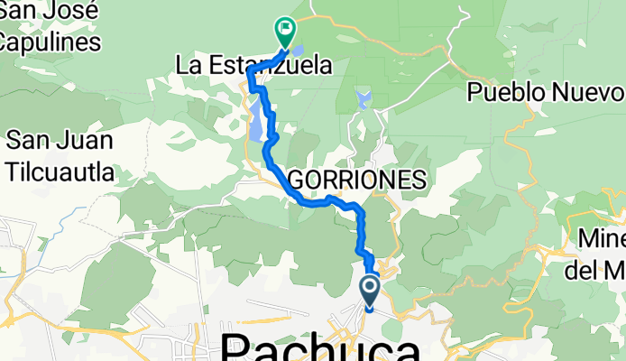
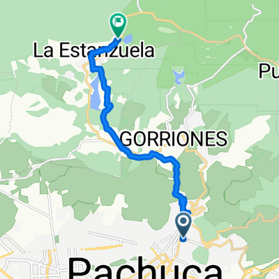
Pachuca - Almoloya
A cycling route starting in Pachuca, Hidalgo, Mexico.
Overview
About this route
- 59 min
- Duration
- 10.2 km
- Distance
- 527 m
- Ascent
- 140 m
- Descent
- 10.3 km/h
- Avg. speed
- 2,814 m
- Max. altitude

Part of
De Pachuca de Soto a Zacatlán
3 stages
Route quality
Waytypes & surfaces along the route
Waytypes
Quiet road
4.6 km
(45 %)
Road
3.4 km
(33 %)
Surfaces
Unpaved
1.6 km
(16 %)
Unpaved (undefined)
1.6 km
(16 %)
Undefined
8.6 km
(84 %)
Continue with Bikemap
Use, edit, or download this cycling route
You would like to ride Pachuca - Almoloya or customize it for your own trip? Here is what you can do with this Bikemap route:
Free features
- Save this route as favorite or in collections
- Copy & plan your own version of this route
- Sync your route with Garmin or Wahoo
Premium features
Free trial for 3 days, or one-time payment. More about Bikemap Premium.
- Navigate this route on iOS & Android
- Export a GPX / KML file of this route
- Create your custom printout (try it for free)
- Download this route for offline navigation
Discover more Premium features.
Get Bikemap PremiumFrom our community
Other popular routes starting in Pachuca
 Pachuca - Almoloya
- Distance
- 10.2 km
- Ascent
- 527 m
- Descent
- 140 m
- Location
- Pachuca, Hidalgo, Mexico
 Boulevard Río de Las Avenidas, Pachuca de Soto a Cerrada Julián Hoyo, Pachuca de Soto
- Distance
- 37.1 km
- Ascent
- 397 m
- Descent
- 415 m
- Location
- Pachuca, Hidalgo, Mexico
 Ruta para ventanas
- Distance
- 19.3 km
- Ascent
- 637 m
- Descent
- 87 m
- Location
- Pachuca, Hidalgo, Mexico
 De Calle Jaime Nunó 302, Pachuca de Soto a Carretera a San Juan Tizahuapán, San Juan Tizahuapan
- Distance
- 13.8 km
- Ascent
- 580 m
- Descent
- 498 m
- Location
- Pachuca, Hidalgo, Mexico
 Ruta tranquila en Pachuca de Soto
- Distance
- 26.1 km
- Ascent
- 290 m
- Descent
- 291 m
- Location
- Pachuca, Hidalgo, Mexico
 Bikepacking Pachuca
- Distance
- 55.5 km
- Ascent
- 1,301 m
- Descent
- 2,015 m
- Location
- Pachuca, Hidalgo, Mexico
 De Avenida 2 400A, Pachuca de Soto a Circuito Doña Mina 510, Pachuca de Soto
- Distance
- 12 km
- Ascent
- 498 m
- Descent
- 336 m
- Location
- Pachuca, Hidalgo, Mexico
 De Calle 14 103, Pachuca de Soto a Avenida Industrial La Paz Mz E Lt 40, Pachuca de Soto
- Distance
- 7.2 km
- Ascent
- 23 m
- Descent
- 84 m
- Location
- Pachuca, Hidalgo, Mexico
Open it in the app