
De Pachuca de Soto a Zacatlán
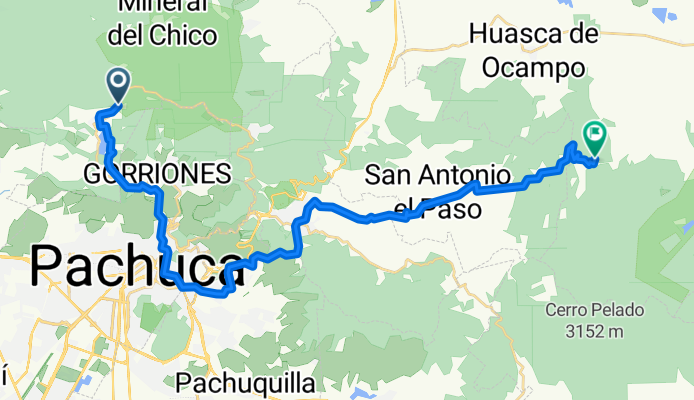
Almoloya - Zacatlán
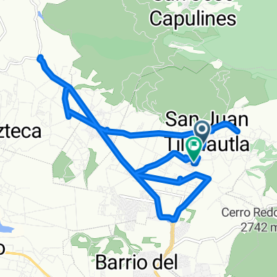
A cycling route starting in San Miguel Cerezo (El Cerezo), Hidalgo, Mexico.
Overview
About this route
- 2 h 55 min
- Duration
- 39.5 km
- Distance
- 1,021 m
- Ascent
- 1,608 m
- Descent
- 13.6 km/h
- Avg. speed
- 2,856 m
- Max. altitude
Part of
De Pachuca de Soto a Zacatlán
3 stages
Route quality
Waytypes & surfaces along the route
Waytypes
Quiet road
29.7 km
(75 %)
Road
5.5 km
(14 %)
Surfaces
Paved
2.8 km
(7 %)
Unpaved
17.4 km
(44 %)
Unpaved (undefined)
17.4 km
(44 %)
Concrete
2.4 km
(6 %)
Continue with Bikemap
Use, edit, or download this cycling route
You would like to ride Almoloya - Zacatlán or customize it for your own trip? Here is what you can do with this Bikemap route:
Free features
- Save this route as favorite or in collections
- Copy & plan your own version of this route
- Sync your route with Garmin or Wahoo
Premium features
Free trial for 3 days, or one-time payment. More about Bikemap Premium.
- Navigate this route on iOS & Android
- Export a GPX / KML file of this route
- Create your custom printout (try it for free)
- Download this route for offline navigation
Discover more Premium features.
Get Bikemap PremiumFrom our community
Other popular routes starting in San Miguel Cerezo (El Cerezo)
 De Unnamed Road, Carboneras a A Carboneras
- Distance
- 5 km
- Ascent
- 130 m
- Descent
- 137 m
- Location
- San Miguel Cerezo (El Cerezo), Hidalgo, Mexico
 De Avenida Benito Juárez 137 a Avenida Benito Juárez
- Distance
- 19.8 km
- Ascent
- 225 m
- Descent
- 273 m
- Location
- San Miguel Cerezo (El Cerezo), Hidalgo, Mexico
 Ruta constante en
- Distance
- 4.2 km
- Ascent
- 80 m
- Descent
- 57 m
- Location
- San Miguel Cerezo (El Cerezo), Hidalgo, Mexico
 Avenida General Alfonso Corona del Rosal 3, Mineral del Chico a Andador 3 Manzana D 139, Pachuca de Soto
- Distance
- 24.1 km
- Ascent
- 3,665 m
- Descent
- 3,668 m
- Location
- San Miguel Cerezo (El Cerezo), Hidalgo, Mexico
 Balam
Balam- Distance
- 3.3 km
- Ascent
- 296 m
- Descent
- 544 m
- Location
- San Miguel Cerezo (El Cerezo), Hidalgo, Mexico
 De Avenida Benito Juárez a Hidalgo, Benito Juárez
- Distance
- 3.8 km
- Ascent
- 73 m
- Descent
- 72 m
- Location
- San Miguel Cerezo (El Cerezo), Hidalgo, Mexico
 De Recorridos Biciting, Mineral del Chico a Recorridos Biciting, Mineral del Chico
- Distance
- 17.6 km
- Ascent
- 611 m
- Descent
- 612 m
- Location
- San Miguel Cerezo (El Cerezo), Hidalgo, Mexico
 Llano Grande - Carboneras - Peña del Cuervo 7 de agosto 9:53
- Distance
- 18.1 km
- Ascent
- 653 m
- Descent
- 652 m
- Location
- San Miguel Cerezo (El Cerezo), Hidalgo, Mexico
Open it in the app