
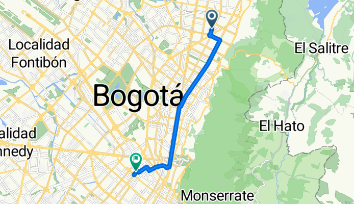
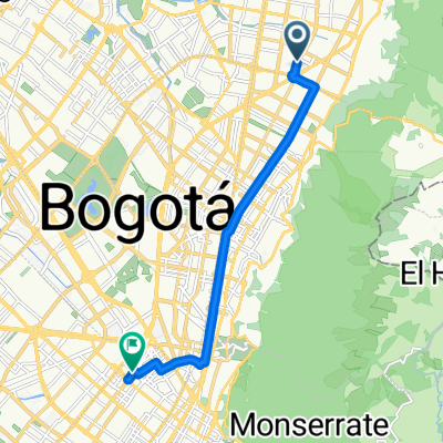
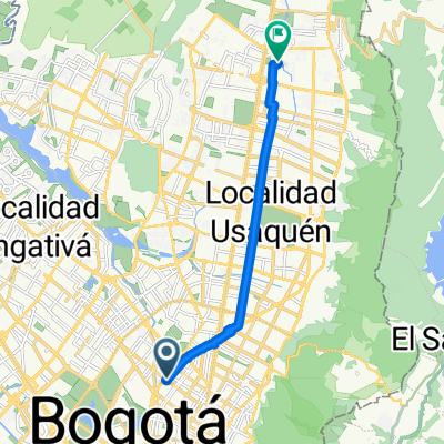
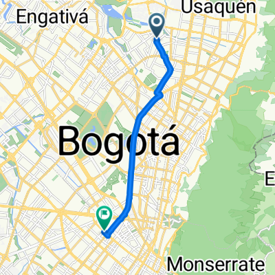
Calle 104, Bogotá to Paloquemao, Bogotá
A cycling route starting in Barrio San Luis, Bogota D.C., Colombia.
Overview
About this route
Start your adventure from the trailhead, where the path unfolds like a ribbon through the landscape. The route is a perfect blend of smooth pavement and occasional gravel sections, ideal for both seasoned cyclists and newcomers alike. As you pedal forward, you'll ascend gently at first, reaching a peak elevation of 2593 meters—a rewarding challenge for those seeking a bit of elevation gain.
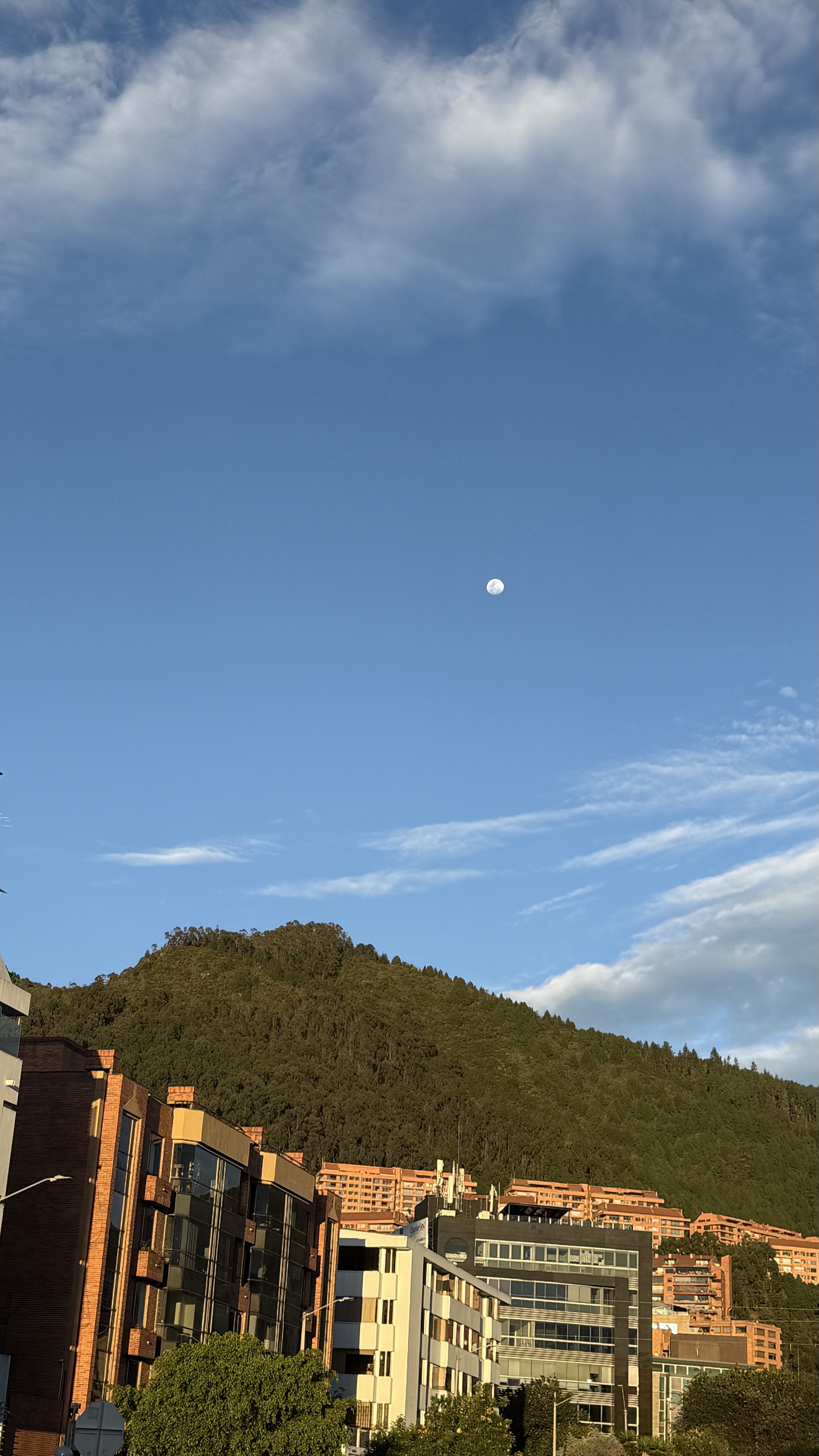
The descent that follows is smooth and exhilarating, offering a chance to unwind after the climb. The route’s elevation profile is well-balanced, with a modest ascent of 66 meters and a gentle descent of 43 meters. Keep an eye out for scenic viewpoints along the way, where you can soak in the breathtaking views of the surrounding peaks.
This cycling route promises a refreshing mix of terrain and elevation, making it perfect for a leisurely ride or a more vigorous challenge. Whether you're navigating this trail on your own or with a group, the journey will be as much about the experience as it is about reaching your destination.
AI generated
- 42 min
- Duration
- 11.7 km
- Distance
- 66 m
- Ascent
- 43 m
- Descent
- 16.6 km/h
- Avg. speed
- 2,593 m
- Max. altitude
Route quality
Waytypes & surfaces along the route
Waytypes
Cycleway
3.3 km
(28 %)
Road
1.8 km
(15 %)
Surfaces
Paved
9.2 km
(79 %)
Asphalt
8.3 km
(71 %)
Paved (undefined)
0.5 km
(4 %)
Continue with Bikemap
Use, edit, or download this cycling route
You would like to ride Calle 104, Bogotá to Paloquemao, Bogotá or customize it for your own trip? Here is what you can do with this Bikemap route:
Free features
- Save this route as favorite or in collections
- Copy & plan your own version of this route
- Sync your route with Garmin or Wahoo
Premium features
Free trial for 3 days, or one-time payment. More about Bikemap Premium.
- Navigate this route on iOS & Android
- Export a GPX / KML file of this route
- Create your custom printout (try it for free)
- Download this route for offline navigation
Discover more Premium features.
Get Bikemap PremiumFrom our community
Other popular routes starting in Barrio San Luis
 Calle 104, Bogotá to Paloquemao, Bogotá
- Distance
- 11.7 km
- Ascent
- 66 m
- Descent
- 43 m
- Location
- Barrio San Luis, Bogota D.C., Colombia
 De Avenida Calle 19b-31 a Calle 132d # 147A-40
- Distance
- 14.4 km
- Ascent
- 121 m
- Descent
- 147 m
- Location
- Barrio San Luis, Bogota D.C., Colombia
 De Calle 95-29 a Carrera 143a # 132D-8
- Distance
- 6.7 km
- Ascent
- 11 m
- Descent
- 19 m
- Location
- Barrio San Luis, Bogota D.C., Colombia
 ejercicio de sábado 😃💪
- Distance
- 21.8 km
- Ascent
- 265 m
- Descent
- 245 m
- Location
- Barrio San Luis, Bogota D.C., Colombia
 Carrera 29A, Bogotá a Calle 175, Bogotá
- Distance
- 12.2 km
- Ascent
- 77 m
- Descent
- 73 m
- Location
- Barrio San Luis, Bogota D.C., Colombia
 Calle 114a # 56-44 to Calle # 32-86
- Distance
- 10.9 km
- Ascent
- 37 m
- Descent
- 40 m
- Location
- Barrio San Luis, Bogota D.C., Colombia
 De Avenida Calle a Calle 132c 99A-59
- Distance
- 68.5 km
- Ascent
- 463 m
- Descent
- 489 m
- Location
- Barrio San Luis, Bogota D.C., Colombia
 De Calle 95-29 a Calle 132d 140C-16
- Distance
- 6.8 km
- Ascent
- 14 m
- Descent
- 19 m
- Location
- Barrio San Luis, Bogota D.C., Colombia
Open it in the app