
12/11/2025
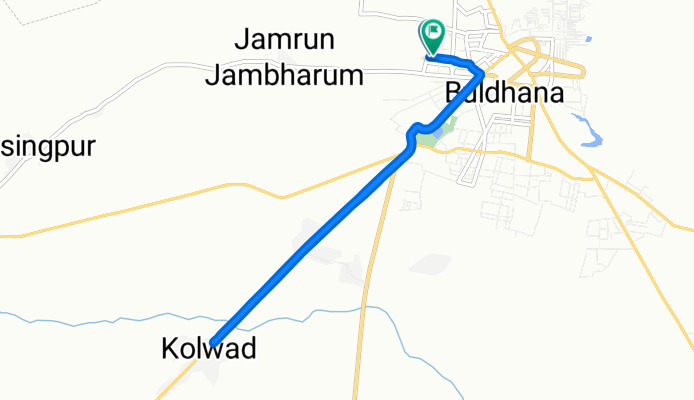
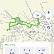
A cycling route starting in Buldāna, Maharashtra, India.
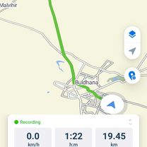
Overview
About this route
- 51 min
- Duration
- 10.5 km
- Distance
- 176 m
- Ascent
- 115 m
- Descent
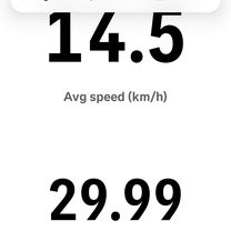
- 12.4 km/h
- Avg. speed
- 683 m
- Max. altitude
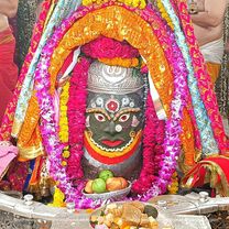
Route photos


Continue with Bikemap
Use, edit, or download this cycling route
You would like to ride 12/11/2025 or customize it for your own trip? Here is what you can do with this Bikemap route:
Free features
- Save this route as favorite or in collections
- Copy & plan your own version of this route
- Sync your route with Garmin or Wahoo
Premium features
Free trial for 3 days, or one-time payment. More about Bikemap Premium.
- Navigate this route on iOS & Android
- Export a GPX / KML file of this route
- Create your custom printout (try it for free)
- Download this route for offline navigation
Discover more Premium features.
Get Bikemap PremiumFrom our community
Other popular routes starting in Buldāna
 home to nadrakoli
- Distance
- 14.9 km
- Ascent
- 232 m
- Descent
- 181 m
- Location
- Buldāna, Maharashtra, India
 Old Ajispur Road to G58H+HR7
- Distance
- 22.8 km
- Ascent
- 195 m
- Descent
- 144 m
- Location
- Buldāna, Maharashtra, India
 home to chikhla
- Distance
- 30.8 km
- Ascent
- 231 m
- Descent
- 216 m
- Location
- Buldāna, Maharashtra, India
 Jambhrun Road Opp to G5PC+PGV
- Distance
- 7.3 km
- Ascent
- 119 m
- Descent
- 148 m
- Location
- Buldāna, Maharashtra, India
 12/11/2025
- Distance
- 10.5 km
- Ascent
- 176 m
- Descent
- 115 m
- Location
- Buldāna, Maharashtra, India
 home to hospital
- Distance
- 7.4 km
- Ascent
- 249 m
- Descent
- 197 m
- Location
- Buldāna, Maharashtra, India
 Nandrakoli
- Distance
- 16.1 km
- Ascent
- 224 m
- Descent
- 180 m
- Location
- Buldāna, Maharashtra, India
 G5PC+PGV to G5PC+PGV
- Distance
- 19.5 km
- Ascent
- 181 m
- Descent
- 122 m
- Location
- Buldāna, Maharashtra, India
Open it in the app