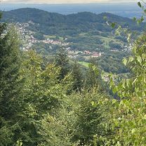
Drei Täler Tour
A cycling route starting in BĂźhlertal, Baden-Wurttemberg, Germany.
Overview
About this route
- -:--
- Duration
- 74.9 km
- Distance
- 2,435 m
- Ascent
- 2,342 m
- Descent
- ---
- Avg. speed
- 1,026 m
- Max. altitude
Route quality
Waytypes & surfaces along the route
Waytypes
Road
28.6 km
(38 %)
Busy road
25.1 km
(34 %)
Surfaces
Paved
69.4 km
(93 %)
Unpaved
0 km
(<1 %)
Asphalt
68.9 km
(92 %)
Paved (undefined)
0.5 km
(<1 %)
Continue with Bikemap
Use, edit, or download this cycling route
You would like to ride Drei Täler Tour or customize it for your own trip? Here is what you can do with this Bikemap route:
Free features
- Save this route as favorite or in collections
- Copy & plan your own version of this route
- Sync your route with Garmin or Wahoo
Premium features
Free trial for 3 days, or one-time payment. More about Bikemap Premium.
- Navigate this route on iOS & Android
- Export a GPX / KML file of this route
- Create your custom printout (try it for free)
- Download this route for offline navigation
Discover more Premium features.
Get Bikemap PremiumFrom our community
Other popular routes starting in BĂźhlertal
- Bßhlertäler Gebirgstour / Falkenfels Bßhlertal
- Distance
- 94.1 km
- Ascent
- 2,600 m
- Descent
- 2,307 m
- Location
- BĂźhlertal, Baden-Wurttemberg, Germany
- Von BĂźhlertal bis Bundenthal
- Distance
- 145.1 km
- Ascent
- 1,902 m
- Descent
- 2,204 m
- Location
- BĂźhlertal, Baden-Wurttemberg, Germany
- Drei Täler Tour
- Distance
- 74.9 km
- Ascent
- 2,435 m
- Descent
- 2,342 m
- Location
- BĂźhlertal, Baden-Wurttemberg, Germany
- Permanente Nordschwarzwald Total
- Distance
- 96.4 km
- Ascent
- 2,301 m
- Descent
- 2,080 m
- Location
- BĂźhlertal, Baden-Wurttemberg, Germany
- Herrenwies 35, Forbach nach Freudenstädter StraĂe 57, LoĂburg
- Distance
- 50.4 km
- Ascent
- 782 m
- Descent
- 961 m
- Location
- BĂźhlertal, Baden-Wurttemberg, Germany
- 2011-04-03 Tour
- Distance
- 29.8 km
- Ascent
- 893 m
- Descent
- 893 m
- Location
- BĂźhlertal, Baden-Wurttemberg, Germany
- BĂźhlertal-Scherrhof-BĂźtthof-BĂźhlertal
- Distance
- 32 km
- Ascent
- 1,302 m
- Descent
- 1,314 m
- Location
- BĂźhlertal, Baden-Wurttemberg, Germany
- Mountainbiketour 005 mit 33Km und 950Hm
- Distance
- 32.1 km
- Ascent
- 868 m
- Descent
- 868 m
- Location
- BĂźhlertal, Baden-Wurttemberg, Germany
Open it in the app