


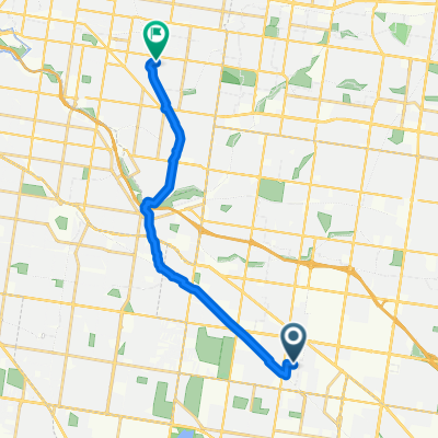
Wright St, Clayton to Allambee Ave, Camberwell
- 14.6 km
- 87 m
- 103 m
- Clayton, Victoria, Australia
A cycling route starting in Clayton, Victoria, Australia.
Overview
Explore a scenic 10.6 km cycling route that offers a delightful mix of gentle climbs and descents. Starting with a gradual ascent of 43 meters, you'll enjoy a smooth ride before descending 71 meters for a refreshing change. The route reaches its highest point at 59 meters, providing a rewarding challenge for cyclists of all levels. This path is perfect for those looking to enjoy a leisurely ride while experiencing a bit of elevation gain and descent.
AI generated
created this 28 days ago
Route quality
Quiet road
6.5 km
(61 %)
Road
2.2 km
(21 %)
Paved
9.6 km
(90 %)
Unpaved
0.4 km
(4 %)
Paved (undefined)
6.4 km
(60 %)
Asphalt
2.9 km
(27 %)
Continue with Bikemap
You would like to ride Clayton Rd, Clayton to Nepean Hwy, Moorabbin or customize it for your own trip? Here is what you can do with this Bikemap route:
Free trial for 3 days, or one-time payment. More about Bikemap Premium.
Discover more Premium features.
Get Bikemap PremiumFrom our community
Open it in the app


