
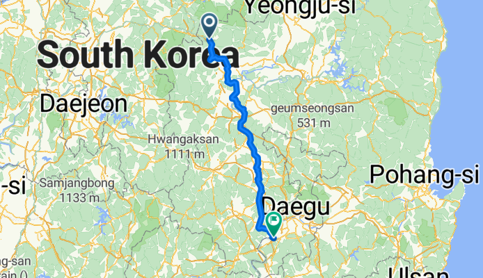
From Incheon to Changnyeong
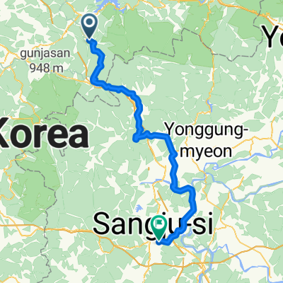
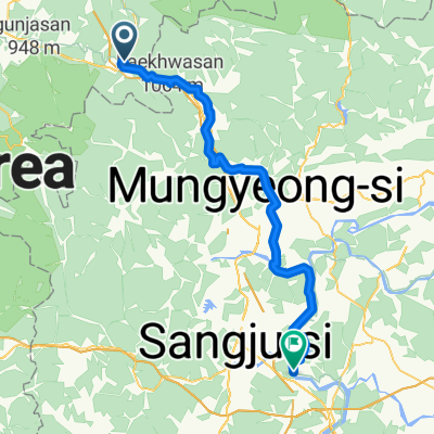
문경 - Hwawŏn
A cycling route starting in Mungyeong, Gyeongsangbuk-do, South Korea.
Overview
About this route
- 9 h 35 min
- Duration
- 151.5 km
- Distance
- 1,585 m
- Ascent
- 1,720 m
- Descent
- 15.8 km/h
- Avg. speed
- 590 m
- Max. altitude

Part of
From Incheon to Changnyeong
4 stages
Route quality
Waytypes & surfaces along the route
Waytypes
Cycleway
109.1 km
(72 %)
Quiet road
18.2 km
(12 %)
Surfaces
Paved
133.3 km
(88 %)
Unpaved
3 km
(2 %)
Asphalt
110.6 km
(73 %)
Concrete
16.7 km
(11 %)
Continue with Bikemap
Use, edit, or download this cycling route
You would like to ride 문경 - Hwawŏn or customize it for your own trip? Here is what you can do with this Bikemap route:
Free features
- Save this route as favorite or in collections
- Copy & plan your own version of this route
- Split it into stages to create a multi-day tour
- Sync your route with Garmin or Wahoo
Premium features
Free trial for 3 days, or one-time payment. More about Bikemap Premium.
- Navigate this route on iOS & Android
- Export a GPX / KML file of this route
- Create your custom printout (try it for free)
- Download this route for offline navigation
Discover more Premium features.
Get Bikemap PremiumFrom our community
Other popular routes starting in Mungyeong
 3일차 여행
- Distance
- 88.7 km
- Ascent
- 2,005 m
- Descent
- 2,149 m
- Location
- Mungyeong, Gyeongsangbuk-do, South Korea
![Suanbo to Mungyeong [easy]](https://media.bikemap.net/routes/17631748/staticmaps/in_0c219f43-be1e-4566-a151-d6359837a392_400x400_bikemap-2021-3D-static.png) Suanbo to Mungyeong [easy]
Suanbo to Mungyeong [easy]- Distance
- 52.8 km
- Ascent
- 1,142 m
- Descent
- 1,262 m
- Location
- Mungyeong, Gyeongsangbuk-do, South Korea
 수안보면 446−7, 충주시 to 수안보면 279−9, 충주시
- Distance
- 98.4 km
- Ascent
- 1,164 m
- Descent
- 1,174 m
- Location
- Mungyeong, Gyeongsangbuk-do, South Korea
 이화령로, 문경시에서 불정동, 문경시까지
- Distance
- 22.1 km
- Ascent
- 64 m
- Descent
- 492 m
- Location
- Mungyeong, Gyeongsangbuk-do, South Korea
 韓国縦走サイクリング5日目(水安堡→楊平)
- Distance
- 148.9 km
- Ascent
- 300 m
- Descent
- 459 m
- Location
- Mungyeong, Gyeongsangbuk-do, South Korea
 hotel
hotel- Distance
- 26.3 km
- Ascent
- 227 m
- Descent
- 307 m
- Location
- Mungyeong, Gyeongsangbuk-do, South Korea
 Mungyeong - Sangju
- Distance
- 68.2 km
- Ascent
- 1,021 m
- Descent
- 1,276 m
- Location
- Mungyeong, Gyeongsangbuk-do, South Korea
 괴산메디오폰도
- Distance
- 106.6 km
- Ascent
- 2,326 m
- Descent
- 2,035 m
- Location
- Mungyeong, Gyeongsangbuk-do, South Korea
Open it in the app