
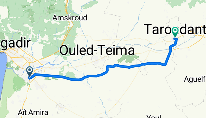
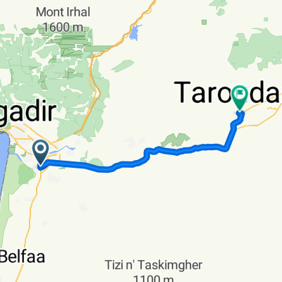
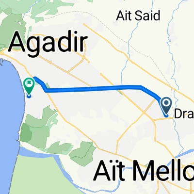
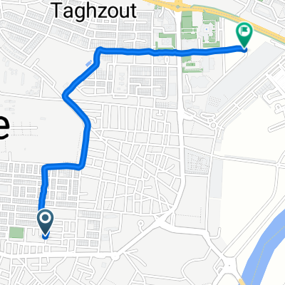
Agadir - Taroudant
A cycling route starting in Inezgane, Région de Souss-Massa-Drâa, Morocco.
Overview
About this route
- 5 h 38 min
- Duration
- 78.2 km
- Distance
- 575 m
- Ascent
- 406 m
- Descent
- 13.9 km/h
- Avg. speed
- 244 m
- Max. altitude
Continue with Bikemap
Use, edit, or download this cycling route
You would like to ride Agadir - Taroudant or customize it for your own trip? Here is what you can do with this Bikemap route:
Free features
- Save this route as favorite or in collections
- Copy & plan your own version of this route
- Sync your route with Garmin or Wahoo
Premium features
Free trial for 3 days, or one-time payment. More about Bikemap Premium.
- Navigate this route on iOS & Android
- Export a GPX / KML file of this route
- Create your custom printout (try it for free)
- Download this route for offline navigation
Discover more Premium features.
Get Bikemap PremiumFrom our community
Other popular routes starting in Inezgane
 Agadir - Taroudant
- Distance
- 78.2 km
- Ascent
- 575 m
- Descent
- 406 m
- Location
- Inezgane, Région de Souss-Massa-Drâa, Morocco
 Airport-Taroudant
- Distance
- 80.4 km
- Ascent
- 198 m
- Descent
- 24 m
- Location
- Inezgane, Région de Souss-Massa-Drâa, Morocco
 Itinéraire récupéré
- Distance
- 29.7 km
- Ascent
- 146 m
- Descent
- 152 m
- Location
- Inezgane, Région de Souss-Massa-Drâa, Morocco
 Easy ride
- Distance
- 21.5 km
- Ascent
- 93 m
- Descent
- 135 m
- Location
- Inezgane, Région de Souss-Massa-Drâa, Morocco
 Marokko 2012
- Distance
- 1,206.2 km
- Ascent
- 5,807 m
- Descent
- 5,809 m
- Location
- Inezgane, Région de Souss-Massa-Drâa, Morocco
 Route in Agadir
- Distance
- 12.5 km
- Ascent
- 33 m
- Descent
- 71 m
- Location
- Inezgane, Région de Souss-Massa-Drâa, Morocco
 MA_Agadir-Oarzazate
- Distance
- 365.2 km
- Ascent
- 2,191 m
- Descent
- 1,127 m
- Location
- Inezgane, Région de Souss-Massa-Drâa, Morocco
 De rue el massira à Inezgane
- Distance
- 2.3 km
- Ascent
- 102 m
- Descent
- 89 m
- Location
- Inezgane, Région de Souss-Massa-Drâa, Morocco
Open it in the app