
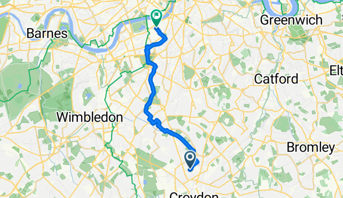
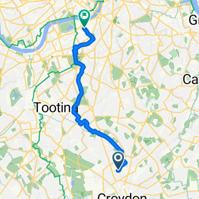
Mayday Road, Thornton Heath to Thessaly House, London
A cycling route starting in Croydon, England, United Kingdom.
Overview
About this route
Embark on a scenic 16.1 km cycling adventure that takes you through varied terrains, offering both gentle climbs and exhilarating descents. Starting at a moderate elevation, you'll ascend 34 meters, gradually building your strength and endurance. The route features a maximum elevation of 52 meters, providing a rewarding challenge for cyclists seeking a bit of adventure. As you descend, you'll enjoy a total of 79 meters of downhill, perfect for a thrilling finish to your ride. The surface varies, with some sections paved for smooth rides and others unpaved for a more rugged experience. This route is ideal for those looking to explore the natural beauty of the area while enjoying a mix of terrain and elevation changes.
AI generated
- 1 h 12 min
- Duration
- 16.1 km
- Distance
- 34 m
- Ascent
- 79 m
- Descent
- 13.5 km/h
- Avg. speed
- 53 m
- Max. altitude

Route quality
Waytypes & surfaces along the route
Waytypes
Quiet road
10.6 km
(66 %)
Cycleway
3.2 km
(20 %)
Surfaces
Paved
10.3 km
(64 %)
Asphalt
10.1 km
(63 %)
Paved (undefined)
0.2 km
(1 %)
Undefined
5.8 km
(36 %)
Continue with Bikemap
Use, edit, or download this cycling route
You would like to ride Mayday Road, Thornton Heath to Thessaly House, London or customize it for your own trip? Here is what you can do with this Bikemap route:
Free features
- Save this route as favorite or in collections
- Copy & plan your own version of this route
- Sync your route with Garmin or Wahoo
Premium features
Free trial for 3 days, or one-time payment. More about Bikemap Premium.
- Navigate this route on iOS & Android
- Export a GPX / KML file of this route
- Create your custom printout (try it for free)
- Download this route for offline navigation
Discover more Premium features.
Get Bikemap PremiumFrom our community
Other popular routes starting in Croydon
 Vanguard Way - Vanguard Way on AllTrails
- Distance
- 108 km
- Ascent
- 0 m
- Descent
- 0 m
- Location
- Croydon, England, United Kingdom
 Campbell Road, Croydon to Campbell Road, Croydon
- Distance
- 23.7 km
- Ascent
- 80 m
- Descent
- 79 m
- Location
- Croydon, England, United Kingdom
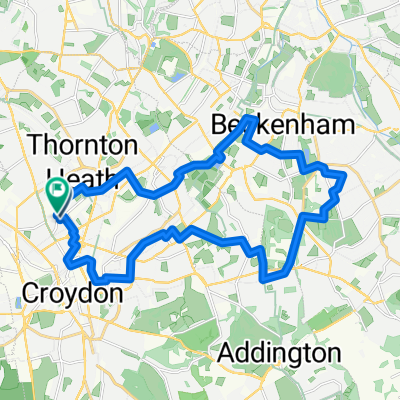
 Croydon to Bletchingley Loop
- Distance
- 52.1 km
- Ascent
- 504 m
- Descent
- 504 m
- Location
- Croydon, England, United Kingdom
 Lennard Road 12-18 to Winery Lane
- Distance
- 23.1 km
- Ascent
- 31 m
- Descent
- 71 m
- Location
- Croydon, England, United Kingdom
 4 Parks in Croydon
- Distance
- 18.9 km
- Ascent
- 134 m
- Descent
- 133 m
- Location
- Croydon, England, United Kingdom
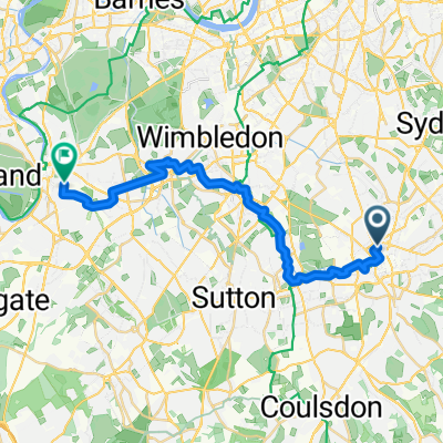
 Croydon, Croydon to Cycleway Six, London
- Distance
- 19.9 km
- Ascent
- 113 m
- Descent
- 160 m
- Location
- Croydon, England, United Kingdom
 MTB-Biggin Hill from East Croydon
- Distance
- 48.6 km
- Ascent
- 580 m
- Descent
- 580 m
- Location
- Croydon, England, United Kingdom
 Mayday Road, Thornton Heath to Thessaly House, London
- Distance
- 16.1 km
- Ascent
- 34 m
- Descent
- 79 m
- Location
- Croydon, England, United Kingdom
Open it in the app