

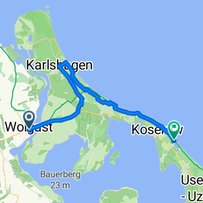
Am Stadion, Wolgast nach Am Stadion, Wolgast
A cycling route starting in Wolgast, Mecklenburg-Vorpommern, Germany.
Overview
About this route
- 1 h 14 min
- Duration
- 14 km
- Distance
- 67 m
- Ascent
- 65 m
- Descent
- 11.4 km/h
- Avg. speed
- 25 m
- Max. altitude
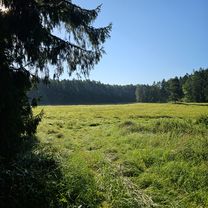
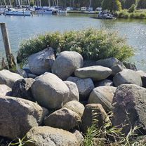
Route photos

Route quality
Waytypes & surfaces along the route
Waytypes
Path
4.2 km
(30 %)
Pedestrian area
3.1 km
(22 %)
Surfaces
Paved
6.7 km
(48 %)
Unpaved
2.1 km
(15 %)
Asphalt
6.7 km
(48 %)
Loose gravel
2 km
(14 %)
Continue with Bikemap
Use, edit, or download this cycling route
You would like to ride Am Stadion, Wolgast nach Am Stadion, Wolgast or customize it for your own trip? Here is what you can do with this Bikemap route:
Free features
- Save this route as favorite or in collections
- Copy & plan your own version of this route
- Sync your route with Garmin or Wahoo
Premium features
Free trial for 3 days, or one-time payment. More about Bikemap Premium.
- Navigate this route on iOS & Android
- Export a GPX / KML file of this route
- Create your custom printout (try it for free)
- Download this route for offline navigation
Discover more Premium features.
Get Bikemap PremiumFrom our community
Other popular routes starting in Wolgast
 wolgast neu
- Distance
- 223.6 km
- Ascent
- 781 m
- Descent
- 781 m
- Location
- Wolgast, Mecklenburg-Vorpommern, Germany
 Wolgast bis Kölpinsee
- Distance
- 31.2 km
- Ascent
- 124 m
- Descent
- 128 m
- Location
- Wolgast, Mecklenburg-Vorpommern, Germany
 Wolfram und Wolfgang von Wolgast nach Misdroy
- Distance
- 62.1 km
- Ascent
- 173 m
- Descent
- 177 m
- Location
- Wolgast, Mecklenburg-Vorpommern, Germany
 Route mit Tanja
- Distance
- 33.6 km
- Ascent
- 214 m
- Descent
- 232 m
- Location
- Wolgast, Mecklenburg-Vorpommern, Germany
 Wolgast - Tribsees
- Distance
- 87.2 km
- Ascent
- 253 m
- Descent
- 249 m
- Location
- Wolgast, Mecklenburg-Vorpommern, Germany
 Am Stadion, Wolgast nach Am Stadion, Wolgast
- Distance
- 14 km
- Ascent
- 67 m
- Descent
- 65 m
- Location
- Wolgast, Mecklenburg-Vorpommern, Germany
 Von Wolgast nach Rieth
- Distance
- 94.8 km
- Ascent
- 237 m
- Descent
- 287 m
- Location
- Wolgast, Mecklenburg-Vorpommern, Germany
 Straße der Freundschaft 29A nach Straße der Freundschaft 29A
- Distance
- 37.4 km
- Ascent
- 73 m
- Descent
- 115 m
- Location
- Wolgast, Mecklenburg-Vorpommern, Germany
Open it in the app