

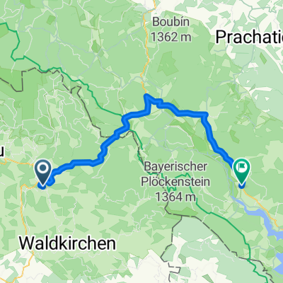
Freyung - Spiegelau - Grafenau - Freyung
A cycling route starting in Freyung, Bavaria, Germany.
Overview
About this route
- -:--
- Duration
- 50.3 km
- Distance
- 708 m
- Ascent
- 708 m
- Descent
- ---
- Avg. speed
- ---
- Max. altitude

Route quality
Waytypes & surfaces along the route
Waytypes
Road
15.1 km
(30 %)
Quiet road
9.5 km
(19 %)
Surfaces
Paved
34.2 km
(68 %)
Asphalt
34.2 km
(68 %)
Undefined
16.1 km
(32 %)
Continue with Bikemap
Use, edit, or download this cycling route
You would like to ride Freyung - Spiegelau - Grafenau - Freyung or customize it for your own trip? Here is what you can do with this Bikemap route:
Free features
- Save this route as favorite or in collections
- Copy & plan your own version of this route
- Sync your route with Garmin or Wahoo
Premium features
Free trial for 3 days, or one-time payment. More about Bikemap Premium.
- Navigate this route on iOS & Android
- Export a GPX / KML file of this route
- Create your custom printout (try it for free)
- Download this route for offline navigation
Discover more Premium features.
Get Bikemap PremiumFrom our community
Other popular routes starting in Freyung
 Freyung - Neureichenau - Waldkirchen - Freynug
- Distance
- 59.3 km
- Ascent
- 772 m
- Descent
- 781 m
- Location
- Freyung, Bavaria, Germany
 Kleine Bayerwaldrundfahrt
- Distance
- 49.7 km
- Ascent
- 994 m
- Descent
- 966 m
- Location
- Freyung, Bavaria, Germany
 Freyung - Moldaustausee (Runde), 150km, 2012-07-08
- Distance
- 149.2 km
- Ascent
- 1,458 m
- Descent
- 1,458 m
- Location
- Freyung, Bavaria, Germany
 Freyung-Herzogsreuter-Wald- Heldengut-Mauth- Freyung
- Distance
- 27.8 km
- Ascent
- 522 m
- Descent
- 522 m
- Location
- Freyung, Bavaria, Germany
 Freyung - Želnava
- Distance
- 52.3 km
- Ascent
- 582 m
- Descent
- 487 m
- Location
- Freyung, Bavaria, Germany
 Dreiländerrundfahrt
- Distance
- 122.4 km
- Ascent
- 1,299 m
- Descent
- 1,299 m
- Location
- Freyung, Bavaria, Germany
 RTF Nationalpark Bayerischer Wald
- Distance
- 153.5 km
- Ascent
- 1,601 m
- Descent
- 1,603 m
- Location
- Freyung, Bavaria, Germany
 20160914_111403.gpx
- Distance
- 26.7 km
- Ascent
- 453 m
- Descent
- 459 m
- Location
- Freyung, Bavaria, Germany
Open it in the app