

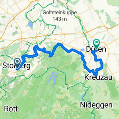
18 Wasserburgen-Route: Etappe 6b Stolberg-Düren
A cycling route starting in Stolberg, North Rhine-Westphalia, Germany.
Overview
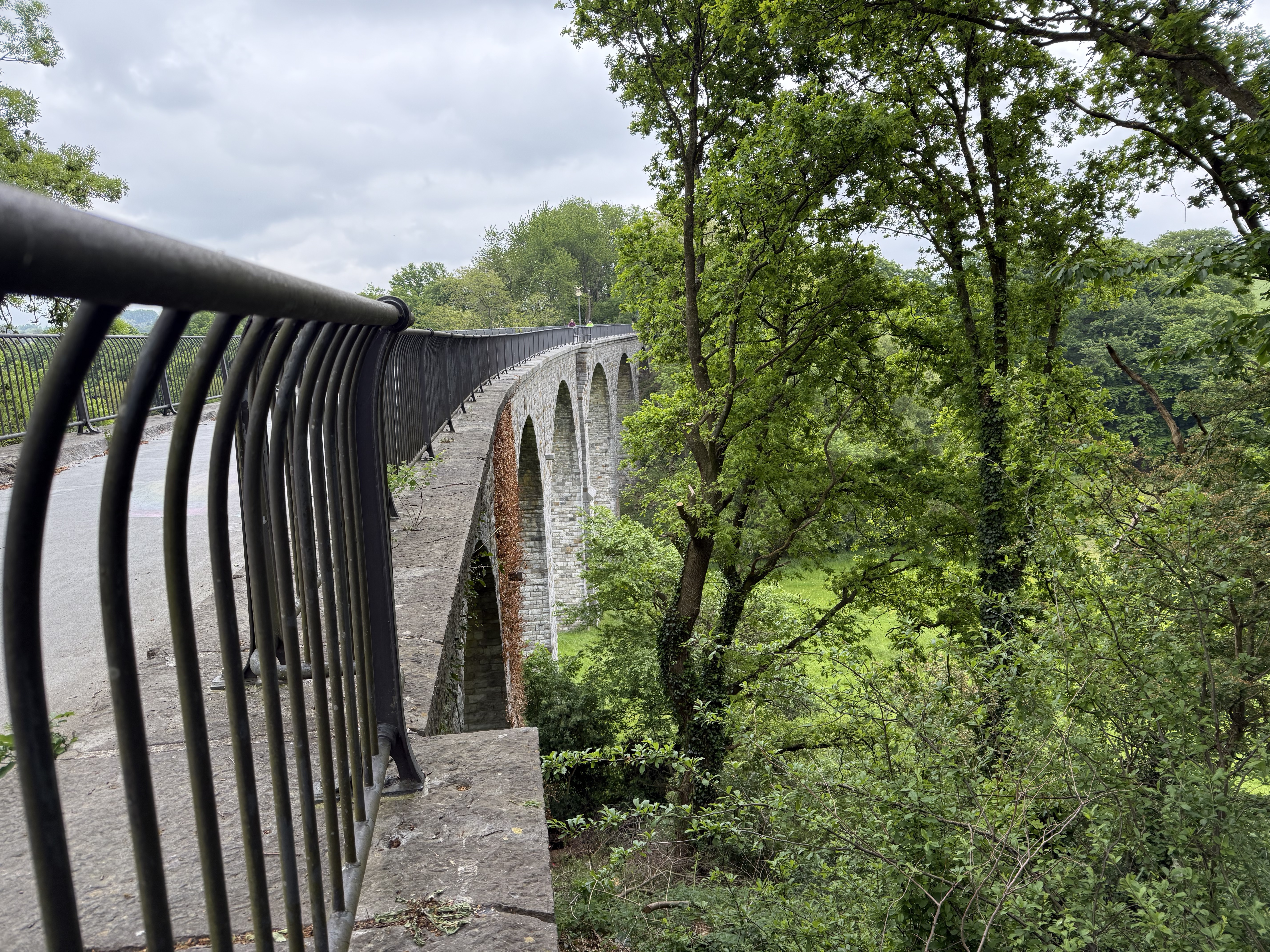
About this route
The approximately 43-kilometre stage runs from the historic old town of Stolberg, the 'copper town', via the pottery town of Langerwehe to Düren. There's plenty to discover, especially for culture enthusiasts.
- 2 h 47 min
- Duration
- 43.6 km
- Distance
- 327 m
- Ascent
- 398 m
- Descent
- 15.6 km/h
- Avg. speed
- 278 m
- Max. altitude

Continue with Bikemap
Use, edit, or download this cycling route
You would like to ride 18 Wasserburgen-Route: Etappe 6b Stolberg-Düren or customize it for your own trip? Here is what you can do with this Bikemap route:
Free features
- Save this route as favorite or in collections
- Copy & plan your own version of this route
- Sync your route with Garmin or Wahoo
Premium features
Free trial for 3 days, or one-time payment. More about Bikemap Premium.
- Navigate this route on iOS & Android
- Export a GPX / KML file of this route
- Create your custom printout (try it for free)
- Download this route for offline navigation
Discover more Premium features.
Get Bikemap PremiumFrom our community
Other popular routes starting in Stolberg
 Promenade 5a nach Stadtstraße
- Distance
- 28.5 km
- Ascent
- 395 m
- Descent
- 256 m
- Location
- Stolberg, North Rhine-Westphalia, Germany
 18 Wasserburgen-Route: Etappe 6b Stolberg-Düren
- Distance
- 43.6 km
- Ascent
- 327 m
- Descent
- 398 m
- Location
- Stolberg, North Rhine-Westphalia, Germany
 Zwei-Talsperren-Runde
- Distance
- 45.9 km
- Ascent
- 384 m
- Descent
- 384 m
- Location
- Stolberg, North Rhine-Westphalia, Germany
 Vlissingen
- Distance
- 250.6 km
- Ascent
- 111 m
- Descent
- 283 m
- Location
- Stolberg, North Rhine-Westphalia, Germany
 Kornelimunster to Bahnhofplatz, Aachen
- Distance
- 20 km
- Ascent
- 137 m
- Descent
- 196 m
- Location
- Stolberg, North Rhine-Westphalia, Germany
 Bobenden, Aachen nach Raerener Straße, Raeren
- Distance
- 7.1 km
- Ascent
- 64 m
- Descent
- 31 m
- Location
- Stolberg, North Rhine-Westphalia, Germany
 Beckerstraße nach Lintertstraße
- Distance
- 4.2 km
- Ascent
- 7 m
- Descent
- 69 m
- Location
- Stolberg, North Rhine-Westphalia, Germany
 MTB Breinigerberg
- Distance
- 25.4 km
- Ascent
- 251 m
- Descent
- 249 m
- Location
- Stolberg, North Rhine-Westphalia, Germany
Open it in the app