

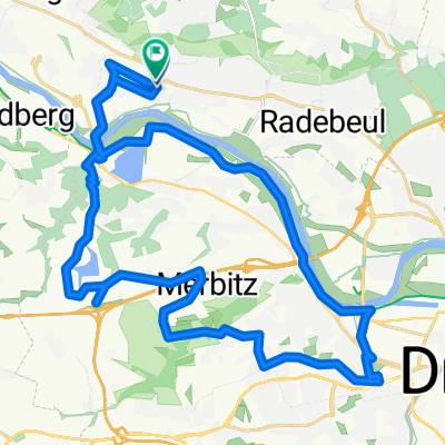
Tretmühle-Lauterbach-Ebersbach-Moritzburg
A cycling route starting in Radebeul, Saxony, Germany.
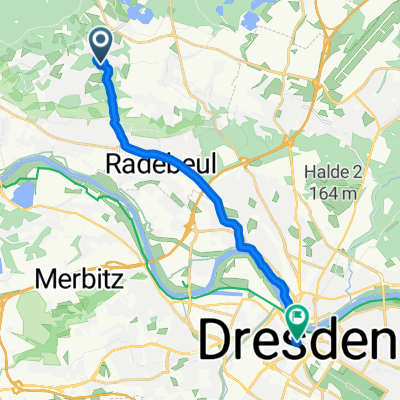
Overview
About this route
3TTT -TretmühlenTrainingsTour:
A leisurely tour to kick off the season through Spitzgrund to Lauterbach and back to Ebersbach. The popular large cobbles in Bärwalde loosen the wrists and shoulder vertebrae, so that the cobbled section in Moritzburg only elicits a tired smile.
- -:--
- Duration
- 45.9 km
- Distance
- 251 m
- Ascent
- 193 m
- Descent
- ---
- Avg. speed
- 205 m
- Max. altitude

Route quality
Waytypes & surfaces along the route
Waytypes
Quiet road
18.8 km
(41 %)
Road
17.9 km
(39 %)
Surfaces
Paved
36.7 km
(80 %)
Unpaved
2.8 km
(6 %)
Asphalt
36.2 km
(79 %)
Gravel
1.4 km
(3 %)
Continue with Bikemap
Use, edit, or download this cycling route
You would like to ride Tretmühle-Lauterbach-Ebersbach-Moritzburg or customize it for your own trip? Here is what you can do with this Bikemap route:
Free features
- Save this route as favorite or in collections
- Copy & plan your own version of this route
- Sync your route with Garmin or Wahoo
Premium features
Free trial for 3 days, or one-time payment. More about Bikemap Premium.
- Navigate this route on iOS & Android
- Export a GPX / KML file of this route
- Create your custom printout (try it for free)
- Download this route for offline navigation
Discover more Premium features.
Get Bikemap PremiumFrom our community
Other popular routes starting in Radebeul
 20.07.25 Güterhofstraße, Radebeul nach Güterhofstraße, Radebeul
- Distance
- 34.2 km
- Ascent
- 342 m
- Descent
- 349 m
- Location
- Radebeul, Saxony, Germany
 Radebeul-Bärwalde-Volkersdorf-Radebeul
- Distance
- 35.3 km
- Ascent
- 188 m
- Descent
- 188 m
- Location
- Radebeul, Saxony, Germany
 Morgenleite nach Wilsdruffer Straße
- Distance
- 13.5 km
- Ascent
- 85 m
- Descent
- 220 m
- Location
- Radebeul, Saxony, Germany
 Schnelle Feierabend Runde
- Distance
- 46.1 km
- Ascent
- 305 m
- Descent
- 308 m
- Location
- Radebeul, Saxony, Germany
 Wilhelm-Eichler-Straße nach Gutsweg 8A
- Distance
- 30 km
- Ascent
- 315 m
- Descent
- 345 m
- Location
- Radebeul, Saxony, Germany
 Tretmühle-Lauterbach-Ebersbach-Moritzburg
- Distance
- 45.9 km
- Ascent
- 251 m
- Descent
- 193 m
- Location
- Radebeul, Saxony, Germany
 Radebeul - Moritzburg
- Distance
- 35.5 km
- Ascent
- 247 m
- Descent
- 247 m
- Location
- Radebeul, Saxony, Germany
 Intervalltraining
- Distance
- 24.9 km
- Ascent
- 257 m
- Descent
- 208 m
- Location
- Radebeul, Saxony, Germany
Open it in the app