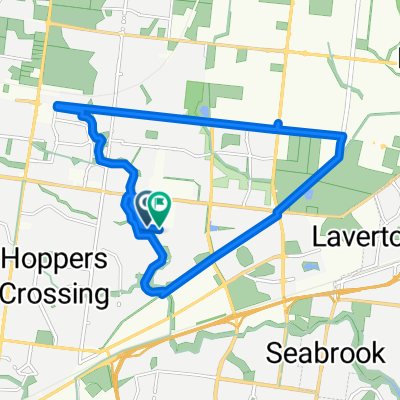
Isolation Truganina Triangle
- 19.6 km
- 63 m
- 62 m
- Williams Landing, Victoria, Australia
A cycling route starting in Williams Landing, Victoria, Australia.
Overview
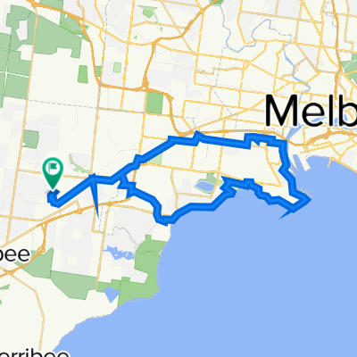
Embark on an exciting cycling adventure along this 50.8 km route, where every pedal stroke brings a new experience. Begin with a gentle ascent of 161 meters, setting the stage for the exhilarating descent of 113 meters that follows. The journey peaks at a maximum elevation of 71 meters, offering breathtaking vistas and a rewarding challenge. This route caters to cyclists of all levels, providing a balanced mix of climbing and descending, perfect for those who love a varied and engaging ride. Enjoy the scenic beauty and the thrill of the terrain as you explore this captivating path.
AI generated
created this 25 days ago
Route quality
Cycleway
49.6 km
(97 %)
Road
0.5 km
(1 %)
Paved
50.7 km
(99 %)
Concrete
36.8 km
(72 %)
Asphalt
7.7 km
(15 %)
Continue with Bikemap
You would like to ride Bridgewater Way, Truganina to Bakers Rd, Coburg North or customize it for your own trip? Here is what you can do with this Bikemap route:
Free trial for 3 days, or one-time payment. More about Bikemap Premium.
Discover more Premium features.
Get Bikemap PremiumFrom our community
Open it in the app