
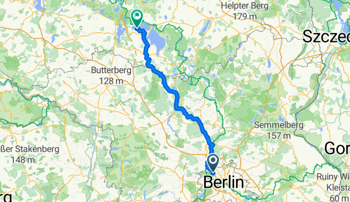
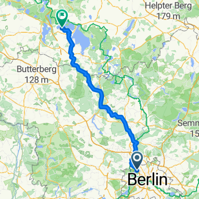
Von Berlin bis Göhren-Lebbin
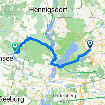
A cycling route starting in Tegel, State of Berlin, Germany.
Overview
About this route
- 9 h
- Duration
- 152.6 km
- Distance
- 728 m
- Ascent
- 690 m
- Descent
- 17 km/h
- Avg. speed
- 115 m
- Max. altitude
Route quality
Waytypes & surfaces along the route
Waytypes
Path
62.6 km
(41 %)
Quiet road
32 km
(21 %)
Surfaces
Paved
126.6 km
(83 %)
Unpaved
3.1 km
(2 %)
Asphalt
120.5 km
(79 %)
Concrete
4.6 km
(3 %)
Continue with Bikemap
Use, edit, or download this cycling route
You would like to ride Von Berlin bis Göhren-Lebbin or customize it for your own trip? Here is what you can do with this Bikemap route:
Free features
- Save this route as favorite or in collections
- Copy & plan your own version of this route
- Split it into stages to create a multi-day tour
- Sync your route with Garmin or Wahoo
Premium features
Free trial for 3 days, or one-time payment. More about Bikemap Premium.
- Navigate this route on iOS & Android
- Export a GPX / KML file of this route
- Create your custom printout (try it for free)
- Download this route for offline navigation
Discover more Premium features.
Get Bikemap PremiumFrom our community
Other popular routes starting in Tegel
 Kurze Radrunde durch Berlin
- Distance
- 2.1 km
- Ascent
- 24 m
- Descent
- 19 m
- Location
- Tegel, State of Berlin, Germany
 Schubartstraße, Berlin nach Weingartnerallee, Falkensee
- Distance
- 20.3 km
- Ascent
- 63 m
- Descent
- 65 m
- Location
- Tegel, State of Berlin, Germany
 MTB Tour: Tegel > Eberswalde modified Tegel>Werbellinsee
- Distance
- 97.2 km
- Ascent
- 201 m
- Descent
- 199 m
- Location
- Tegel, State of Berlin, Germany
 2009 Sonntagstour Tegel ->Nordwärts Landstrasse
- Distance
- 74.9 km
- Ascent
- 148 m
- Descent
- 153 m
- Location
- Tegel, State of Berlin, Germany
 Von Berlin bis Göhren-Lebbin
- Distance
- 152.6 km
- Ascent
- 728 m
- Descent
- 690 m
- Location
- Tegel, State of Berlin, Germany
 NordTour_Rundfahrt
- Distance
- 36.4 km
- Ascent
- 103 m
- Descent
- 97 m
- Location
- Tegel, State of Berlin, Germany
 Buddestraße nach Veitstraße 43a
- Distance
- 51.3 km
- Ascent
- 271 m
- Descent
- 319 m
- Location
- Tegel, State of Berlin, Germany
 Tegel 10, 48 Km - eine Fahrt im Schatten
- Distance
- 47.6 km
- Ascent
- 227 m
- Descent
- 224 m
- Location
- Tegel, State of Berlin, Germany
Open it in the app