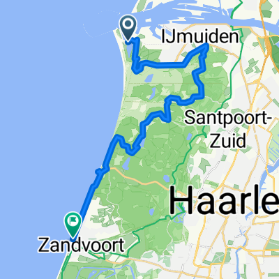
Kennemermeer, IJmuiden nach Seinpostweg, Zandvoort
- 23.2 km
- 98 m
- 96 m
- Velsen, North Holland, The Netherlands
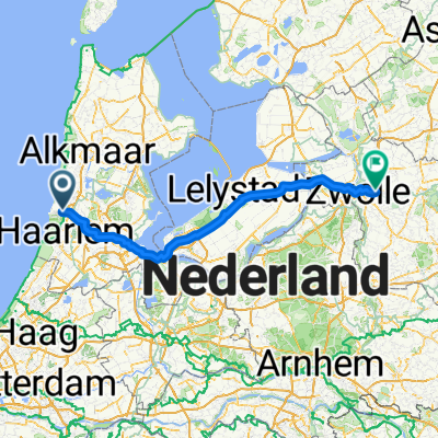
A cycling route starting in Velsen, North Holland, The Netherlands.
Overview
Embark on an exhilarating cycling adventure along this 217.7 km route, perfect for those seeking a challenge with stunning views. Starting from a scenic location, you'll experience a gentle ascent of 540 meters, gradually building your stamina as you reach the highest point at 90 meters. The descent offers a thrilling 528 meters of downhill fun, providing a rewarding balance of challenge and enjoyment. The route is mostly paved, ensuring a smooth and comfortable ride. Whether you're a seasoned cyclist or a weekend warrior, this path promises an unforgettable experience through varied landscapes and breathtaking vistas.
AI generated
created this 1 month ago
Route quality
Cycleway
76.1 km
(35 %)
Road
58.7 km
(27 %)
Paved
123.9 km
(57 %)
Unpaved
4.3 km
(2 %)
Asphalt
119.5 km
(55 %)
Concrete
4.3 km
(2 %)
Continue with Bikemap
You would like to ride TET_NL-01_20251024 or customize it for your own trip? Here is what you can do with this Bikemap route:
Free trial for 3 days, or one-time payment. More about Bikemap Premium.
Discover more Premium features.
Get Bikemap PremiumFrom our community
Open it in the app