
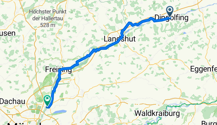
Overview
About this route
- 5 h 27 min
- Duration
- 96.2 km
- Distance
- 518 m
- Ascent
- 389 m
- Descent
- 17.6 km/h
- Avg. speed
- 496 m
- Max. altitude
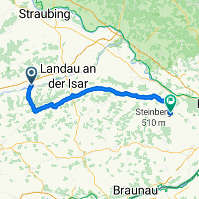
Part of
Von Linz bis Bregenz
5 stages
Route quality
Waytypes & surfaces along the route
Waytypes
Quiet road
35.6 km
(37 %)
Path
31.7 km
(33 %)
Surfaces
Paved
90.4 km
(94 %)
Unpaved
3.8 km
(4 %)
Asphalt
82.7 km
(86 %)
Paved (undefined)
6.7 km
(7 %)
Continue with Bikemap
Use, edit, or download this cycling route
You would like to ride Dingolfing - Garching or customize it for your own trip? Here is what you can do with this Bikemap route:
Free features
- Save this route as favorite or in collections
- Copy & plan your own version of this route
- Split it into stages to create a multi-day tour
- Sync your route with Garmin or Wahoo
Premium features
Free trial for 3 days, or one-time payment. More about Bikemap Premium.
- Navigate this route on iOS & Android
- Export a GPX / KML file of this route
- Create your custom printout (try it for free)
- Download this route for offline navigation
Discover more Premium features.
Get Bikemap PremiumFrom our community
Other popular routes starting in Dingolfing
 Dingolfing - Vilshofen
- Distance
- 61.9 km
- Ascent
- 293 m
- Descent
- 344 m
- Location
- Dingolfing, Bavaria, Germany
 Bayernwerkstraße do Bayernwerkstraße
- Distance
- 24.3 km
- Ascent
- 274 m
- Descent
- 312 m
- Location
- Dingolfing, Bavaria, Germany
 Dingolfing - Tiefenbach
- Distance
- 72.7 km
- Ascent
- 325 m
- Descent
- 377 m
- Location
- Dingolfing, Bavaria, Germany
 Dingolfing nach Marktplatz
- Distance
- 79.2 km
- Ascent
- 407 m
- Descent
- 416 m
- Location
- Dingolfing, Bavaria, Germany
 Hartlwirt_Hintour
- Distance
- 18.1 km
- Ascent
- 103 m
- Descent
- 81 m
- Location
- Dingolfing, Bavaria, Germany
 Dingolfing - Greilsberg und zurück
- Distance
- 47.4 km
- Ascent
- 452 m
- Descent
- 410 m
- Location
- Dingolfing, Bavaria, Germany
 Dingolfing - Munchen
- Distance
- 113.9 km
- Ascent
- 180 m
- Descent
- 9 m
- Location
- Dingolfing, Bavaria, Germany
 Ostwindstrecke
- Distance
- 58.4 km
- Ascent
- 328 m
- Descent
- 325 m
- Location
- Dingolfing, Bavaria, Germany
Open it in the app