

Bayerwaldtour
A cycling route starting in Regen, Bavaria, Germany.
Overview
About this route
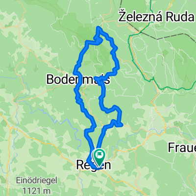
Die Route fürht von Regen bis Miltach auf dem REGENTAL-RADWEG und von Miltach bis Bogen auf dem DONAU-REGEN-Radweg. Der Rest von bogen nach Straubing auf dem Donauradweg.
Tatsächlich war die Tour aber ca. 100 km und relativ anstrengend
- -:--
- Duration
- 84.1 km
- Distance
- 593 m
- Ascent
- 818 m
- Descent
- ---
- Avg. speed
- ---
- Max. altitude
Continue with Bikemap
Use, edit, or download this cycling route
You would like to ride Bayerwaldtour or customize it for your own trip? Here is what you can do with this Bikemap route:
Free features
- Save this route as favorite or in collections
- Copy & plan your own version of this route
- Split it into stages to create a multi-day tour
- Sync your route with Garmin or Wahoo
Premium features
Free trial for 3 days, or one-time payment. More about Bikemap Premium.
- Navigate this route on iOS & Android
- Export a GPX / KML file of this route
- Create your custom printout (try it for free)
- Download this route for offline navigation
Discover more Premium features.
Get Bikemap PremiumFrom our community
Other popular routes starting in Regen
 Regen - Zwiesel - Woidroserl
- Distance
- 30.9 km
- Ascent
- 486 m
- Descent
- 487 m
- Location
- Regen, Bavaria, Germany
 Regen-Weissenstein-Rohrbach
- Distance
- 25.5 km
- Ascent
- 425 m
- Descent
- 425 m
- Location
- Regen, Bavaria, Germany
 Regen - Kronberg - Großer Arber - Großer Arbersee - Brandten - Regen
- Distance
- 58 km
- Ascent
- 1,646 m
- Descent
- 1,642 m
- Location
- Regen, Bavaria, Germany
 Heilig-Geist-Gasse 8, Regen nach Heilig-Geist-Gasse 8, Regen
- Distance
- 18.3 km
- Ascent
- 390 m
- Descent
- 390 m
- Location
- Regen, Bavaria, Germany
 Regen-Viechtach-Regen
- Distance
- 57.7 km
- Ascent
- 894 m
- Descent
- 895 m
- Location
- Regen, Bavaria, Germany
 Bayerwaldtour
- Distance
- 84.1 km
- Ascent
- 593 m
- Descent
- 818 m
- Location
- Regen, Bavaria, Germany
 Regen - Harlachberg - Silberberg - Hennenkobel - Schwarzach - Klafferhof - Stausee - Regen
- Distance
- 38.8 km
- Ascent
- 1,086 m
- Descent
- 1,086 m
- Location
- Regen, Bavaria, Germany
 Regen - Katzenbach - Harlachberg - Böhmhof - Brandten
- Distance
- 24.2 km
- Ascent
- 645 m
- Descent
- 581 m
- Location
- Regen, Bavaria, Germany
Open it in the app