Col de l'Epine - col du Chat
A cycling route starting in Cognin, Auvergne-Rhône-Alpes, France.
Overview
About this route
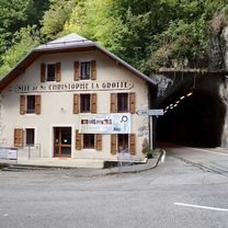
Climb to the Col de l'Epine followed by the Pas du Lièvre. It's nice, mostly under trees and especially with very little traffic.
Caution on the descent after the Pas du Lièvre, the narrow road is littered with small stones that have eroded some paths.
Very little traffic on the climb to the Col du Chat, also shaded under trees.
Return via the cycle path from Bourget (too bad the path is not marked on the map)
- -:--
- Duration
- 55.8 km
- Distance
- 1,209 m
- Ascent
- 1,209 m
- Descent
- ---
- Avg. speed
- ---
- Max. altitude
Continue with Bikemap
Use, edit, or download this cycling route
You would like to ride Col de l'Epine - col du Chat or customize it for your own trip? Here is what you can do with this Bikemap route:
Free features
- Save this route as favorite or in collections
- Copy & plan your own version of this route
- Sync your route with Garmin or Wahoo
Premium features
Free trial for 3 days, or one-time payment. More about Bikemap Premium.
- Navigate this route on iOS & Android
- Export a GPX / KML file of this route
- Create your custom printout (try it for free)
- Download this route for offline navigation
Discover more Premium features.
Get Bikemap PremiumFrom our community
Other popular routes starting in Cognin
 Tour de lac
- Distance
- 72 km
- Ascent
- 956 m
- Descent
- 958 m
- Location
- Cognin, Auvergne-Rhône-Alpes, France
 granier via st baldoph et pas de la fosse
- Distance
- 17.9 km
- Ascent
- 923 m
- Descent
- 57 m
- Location
- Cognin, Auvergne-Rhône-Alpes, France
 Granier - col des Egaux
- Distance
- 53.4 km
- Ascent
- 1,326 m
- Descent
- 1,325 m
- Location
- Cognin, Auvergne-Rhône-Alpes, France
 Chambéry to Voreppe
- Distance
- 47.2 km
- Ascent
- 870 m
- Descent
- 938 m
- Location
- Cognin, Auvergne-Rhône-Alpes, France
 jarrier bidob
- Distance
- 11.8 km
- Ascent
- 76 m
- Descent
- 47 m
- Location
- Cognin, Auvergne-Rhône-Alpes, France
 Le Tour De France: Stage 11
- Distance
- 177.7 km
- Ascent
- 5,240 m
- Descent
- 3,210 m
- Location
- Cognin, Auvergne-Rhône-Alpes, France
 Col de l'Epine - col du Chat
- Distance
- 55.8 km
- Ascent
- 1,209 m
- Descent
- 1,209 m
- Location
- Cognin, Auvergne-Rhône-Alpes, France
 Chambéry - Circle toward Col du Granier
- Distance
- 23.4 km
- Ascent
- 670 m
- Descent
- 673 m
- Location
- Cognin, Auvergne-Rhône-Alpes, France
Open it in the app

