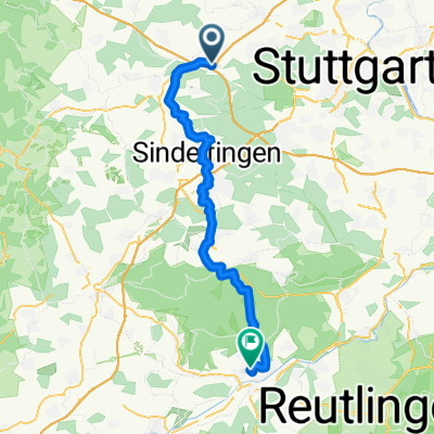
Enztal und Schwarzwald
- 102.9 km
- 1,122 m
- 1,122 m
- Leonberg, Baden-Wurttemberg, Germany
A cycling route starting in Leonberg, Baden-Wurttemberg, Germany.
Overview
The route of the 2011 Tour de Natur starting in the Höfinger Täle.
created this 13 years ago
Route quality
Track
21.7 km
(62 %)
Quiet road
5.9 km
(17 %)
Paved
25.5 km
(73 %)
Unpaved
8.4 km
(24 %)
Asphalt
24.8 km
(71 %)
Gravel
4.2 km
(12 %)
Continue with Bikemap
You would like to ride Tour de Natur 2011 or customize it for your own trip? Here is what you can do with this Bikemap route:
Free trial for 3 days, or one-time payment. More about Bikemap Premium.
Discover more Premium features.
Get Bikemap PremiumFrom our community
Open it in the app