

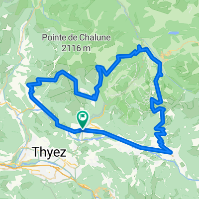
Cols Ramaz, Joux Verte, Encrenaz, Joux Plane
A cycling route starting in Taninges, Auvergne-Rhône-Alpes, France.
Overview
About this route
- -:--
- Duration
- 105.7 km
- Distance
- 2,841 m
- Ascent
- 2,845 m
- Descent
- ---
- Avg. speed
- ---
- Max. altitude

Route quality
Waytypes & surfaces along the route
Waytypes
Road
65.5 km
(62 %)
Quiet road
8.5 km
(8 %)
Surfaces
Paved
82.4 km
(78 %)
Unpaved
5.3 km
(5 %)
Asphalt
78.2 km
(74 %)
Concrete
4.2 km
(4 %)
Route highlights
Points of interest along the route
Point of interest after 20.4 km
Col de la Ramaz
Point of interest after 33 km
Col de l'Encrenaz
Point of interest after 59.4 km
Col de la Joux Verte
Point of interest after 78.9 km
Col du Ranfolly
Point of interest after 81.4 km
Col de Joux Plane
Continue with Bikemap
Use, edit, or download this cycling route
You would like to ride Cols Ramaz, Joux Verte, Encrenaz, Joux Plane or customize it for your own trip? Here is what you can do with this Bikemap route:
Free features
- Save this route as favorite or in collections
- Copy & plan your own version of this route
- Split it into stages to create a multi-day tour
- Sync your route with Garmin or Wahoo
Premium features
Free trial for 3 days, or one-time payment. More about Bikemap Premium.
- Navigate this route on iOS & Android
- Export a GPX / KML file of this route
- Create your custom printout (try it for free)
- Download this route for offline navigation
Discover more Premium features.
Get Bikemap PremiumFrom our community
Other popular routes starting in Taninges
 Col de la Ramaz is closed
- Distance
- 29.5 km
- Ascent
- 875 m
- Descent
- 875 m
- Location
- Taninges, Auvergne-Rhône-Alpes, France
 Franse Alpen stage6
- Distance
- 63.6 km
- Ascent
- 1,126 m
- Descent
- 1,340 m
- Location
- Taninges, Auvergne-Rhône-Alpes, France
 Col de Joux Plane / Encrenaz / Ramaz
- Distance
- 71.3 km
- Ascent
- 2,475 m
- Descent
- 2,021 m
- Location
- Taninges, Auvergne-Rhône-Alpes, France
 proposta2
- Distance
- 113.8 km
- Ascent
- 2,324 m
- Descent
- 2,325 m
- Location
- Taninges, Auvergne-Rhône-Alpes, France
 Col de Joux Plane / Encrenaz / Ramaz2
- Distance
- 75.4 km
- Ascent
- 2,032 m
- Descent
- 2,032 m
- Location
- Taninges, Auvergne-Rhône-Alpes, France
 Taninges - Saint-Jeoire - Marignier - Châtillon sur Cluses - Taninges
- Distance
- 27.8 km
- Ascent
- 320 m
- Descent
- 324 m
- Location
- Taninges, Auvergne-Rhône-Alpes, France
 Taninges Mouille rosse
- Distance
- 11.2 km
- Ascent
- 867 m
- Descent
- 23 m
- Location
- Taninges, Auvergne-Rhône-Alpes, France
 Joux Plane via alternate route
- Distance
- 48.2 km
- Ascent
- 1,278 m
- Descent
- 1,278 m
- Location
- Taninges, Auvergne-Rhône-Alpes, France
Open it in the app