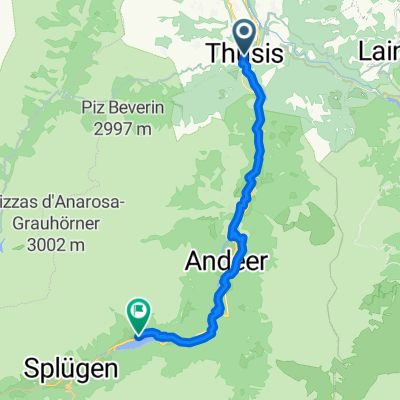
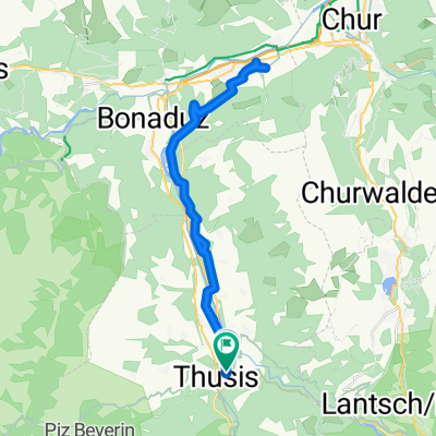
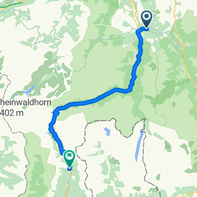
Thusis-Juf
A cycling route starting in Thusis, Grisons, Switzerland.
Overview
About this route
Ein wunderschöne aber anstrengende Tour von Thusis (697 m. ü. M.) durch die Via Mala Schlucht nach Andeer und von dort das Avers Tal hinauf bis zuhinterst nach Juf (2126 m. ü. M.), der höchsten ganzjährig bewohnten Gemeinde von Europa.
- -:--
- Duration
- 39.8 km
- Distance
- 1,754 m
- Ascent
- 338 m
- Descent
- ---
- Avg. speed
- ---
- Avg. speed
Route quality
Waytypes & surfaces along the route
Waytypes
Road
20.9 km
(52 %)
Busy road
7.3 km
(18 %)
Surfaces
Paved
36.8 km
(92 %)
Unpaved
0.7 km
(2 %)
Asphalt
36.6 km
(92 %)
Gravel
0.6 km
(2 %)
Continue with Bikemap
Use, edit, or download this cycling route
You would like to ride Thusis-Juf or customize it for your own trip? Here is what you can do with this Bikemap route:
Free features
- Save this route as favorite or in collections
- Copy & plan your own version of this route
- Sync your route with Garmin or Wahoo
Premium features
Free trial for 3 days, or one-time payment. More about Bikemap Premium.
- Navigate this route on iOS & Android
- Export a GPX / KML file of this route
- Create your custom printout (try it for free)
- Download this route for offline navigation
Discover more Premium features.
Get Bikemap PremiumFrom our community
Other popular routes starting in Thusis
- TdL 3. Etappe
- Distance
- 130.2 km
- Ascent
- 1,251 m
- Descent
- 2,023 m
- Location
- Thusis, Grisons, Switzerland
- 3. Etappe
- Distance
- 127 km
- Ascent
- 1,226 m
- Descent
- 2,001 m
- Location
- Thusis, Grisons, Switzerland
- Bündnertour_05.Tag
- Distance
- 32.4 km
- Ascent
- 1,375 m
- Descent
- 599 m
- Location
- Thusis, Grisons, Switzerland
- 3 Pässe, Albula, Maloja, Splügen
- Distance
- 172.1 km
- Ascent
- 6,572 m
- Descent
- 6,579 m
- Location
- Thusis, Grisons, Switzerland
- Ausgangspunkt zur Via Mala
- Distance
- 66.6 km
- Ascent
- 1,661 m
- Descent
- 2,021 m
- Location
- Thusis, Grisons, Switzerland
- Scalottas-Tgatieni-Scalottas-Heidsee
- Distance
- 14.3 km
- Ascent
- 539 m
- Descent
- 1,311 m
- Location
- Thusis, Grisons, Switzerland
- Bergtour Beverin
- Distance
- 30.8 km
- Ascent
- 1,008 m
- Descent
- 1,008 m
- Location
- Thusis, Grisons, Switzerland
- ch12 Thusis - Felsberg - Bonaduz
- Distance
- 32.1 km
- Ascent
- 440 m
- Descent
- 472 m
- Location
- Thusis, Grisons, Switzerland
Open it in the app