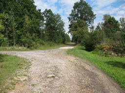
2012/13 Zagnańsk - Krasna - Mokra - Szałasy
A cycling route starting in Zagnańsk, Świętokrzyskie Voivodship, Poland.
Overview
About this route
Trasa przejechana 16 sierpnia 2012 r.
- -:--
- Duration
- 69 km
- Distance
- 474 m
- Ascent
- 474 m
- Descent
- ---
- Avg. speed
- ---
- Max. altitude
Route highlights
Points of interest along the route

Point of interest after 0.7 km
Zachełmie

Point of interest after 2.1 km
Zachełmie, kamieniołom

Point of interest after 2.4 km
Zachełmie, widok w kierunku NW

Point of interest after 5.8 km
Zagnańsk

Point of interest after 7.3 km
Zagnańsk, Dąb Bartek

Point of interest after 10.4 km
Samsonów, stara huta

Point of interest after 15.6 km
Długojów

Point of interest after 17.2 km
trasa Długojów - Rogowice

Point of interest after 18.4 km
Rogowice, bagienne obszary chronione, widok w kierunku NE

Point of interest after 18.5 km
Rogowice

Point of interest after 19.4 km
Rogowice, widok w kierunku SW

Point of interest after 20.3 km
Serbinów

Point of interest after 22.4 km
Serbinów

Point of interest after 23 km
Trasa Serbinów - Krasna

Point of interest after 25.9 km
Krasna

Point of interest after 26.4 km
Krasna

Point of interest after 26.8 km
Krasna, widok w kierunku W

Point of interest after 28.4 km
Trasa Krasna - Modrzewina

Point of interest after 28.6 km
Trasa Krasna - Modrzewina

Point of interest after 29.3 km
trasa Krasna - Modrzewina, rzeka Krasna

Point of interest after 33.1 km
Modrzewina

Point of interest after 35.4 km
trasa Modrzewina - Błotnica, rzeka Krasna

Point of interest after 36.3 km
Błotnica, widok w kierunku NW

Point of interest after 38.5 km
Duraczów

Point of interest after 39.8 km
Mokra

Point of interest after 40.6 km
Mokra

Point of interest after 43 km
trasa Mokra - Gosań

Point of interest after 45.8 km
Gosań

Point of interest after 46.9 km
Nowy Włochów, widok w kierunku SSE

Point of interest after 47.9 km
Nowy Włochów

Point of interest after 48.8 km
trasa Nowy Włochów - Nowy Odrowążek, widok w kierunku SE

Point of interest after 49.3 km
Trasa Nowy Włochów - Nowy Odrowążek, widok w kierunku ESE

Point of interest after 51.4 km
Kucębów, widok w kierunku S

Point of interest after 53.5 km
Szałasy, pomnik nieznanego ułana "Hubala"

Point of interest after 54.9 km
Szałasy, upamiętnienie boju Oddziału H. Dobrzańskiego "Hubala" w dniach 2 - 4. IV. 1940 r.

Point of interest after 55 km
Pomnik pomordowanych przez Niemców mieszkańców Szałasów za pomoc Hubalowi.
Continue with Bikemap
Use, edit, or download this cycling route
You would like to ride 2012/13 Zagnańsk - Krasna - Mokra - Szałasy or customize it for your own trip? Here is what you can do with this Bikemap route:
Free features
- Save this route as favorite or in collections
- Copy & plan your own version of this route
- Sync your route with Garmin or Wahoo
Premium features
Free trial for 3 days, or one-time payment. More about Bikemap Premium.
- Navigate this route on iOS & Android
- Export a GPX / KML file of this route
- Create your custom printout (try it for free)
- Download this route for offline navigation
Discover more Premium features.
Get Bikemap PremiumFrom our community
Other popular routes starting in Zagnańsk
 odyseja zagnańska
- Distance
- 102.5 km
- Ascent
- 709 m
- Descent
- 709 m
- Location
- Zagnańsk, Świętokrzyskie Voivodship, Poland
 Zagnańsk szlaki rowerowe.net
- Distance
- 34 km
- Ascent
- 345 m
- Descent
- 344 m
- Location
- Zagnańsk, Świętokrzyskie Voivodship, Poland
 2012/13 Zagnańsk - Krasna - Mokra - Szałasy
- Distance
- 69 km
- Ascent
- 474 m
- Descent
- 474 m
- Location
- Zagnańsk, Świętokrzyskie Voivodship, Poland
 Zalew Sielpia - krótsza wersja
- Distance
- 89.3 km
- Ascent
- 845 m
- Descent
- 845 m
- Location
- Zagnańsk, Świętokrzyskie Voivodship, Poland
 Sliwka Gruszka test 75km
- Distance
- 75.6 km
- Ascent
- 628 m
- Descent
- 628 m
- Location
- Zagnańsk, Świętokrzyskie Voivodship, Poland
 Góry Świętokrzyskie - wersja długa
- Distance
- 97.7 km
- Ascent
- 1,248 m
- Descent
- 1,245 m
- Location
- Zagnańsk, Świętokrzyskie Voivodship, Poland
 ewaaaaa
- Distance
- 48.3 km
- Ascent
- 372 m
- Descent
- 370 m
- Location
- Zagnańsk, Świętokrzyskie Voivodship, Poland
 WISIÓWKA II
- Distance
- 15.5 km
- Ascent
- 364 m
- Descent
- 245 m
- Location
- Zagnańsk, Świętokrzyskie Voivodship, Poland
Open it in the app

