- 51.2 km
- 161 m
- 114 m
- Williams Landing, Victoria, Australia
Bridgewater Way, Truganina to Bridgewater Way, Truganina
A cycling route starting in Williams Landing, Victoria, Australia.
Overview
About this route
Get ready to pedal through the scenic trails of Route 51! This 51.9 km cycling adventure offers a gentle challenge with an elevation gain of just 55 meters and a similar descent of 52 meters. The route features a mix of paved paths and unpaved trails, perfect for both seasoned cyclists and beginners alike.
As you journey along this route, you'll enjoy picturesque views and a variety of terrain, ensuring an engaging ride. With a maximum elevation of 25 meters, this route is accessible and enjoyable for all skill levels. Whether you're looking for a leisurely ride or a bit more of a challenge, Route 51 promises an unforgettable cycling experience.
AI generated
- 2:32 h
- Duration
- 52.3 km
- Distance
- 56 m
- Ascent
- 53 m
- Descent
- 20.7 km/h
- Avg. speed
- 26 m
- Max. altitude
created this 4 months ago
Route photos
Route quality
Waytypes & surfaces along the route
Waytypes
Cycleway
46.6 km
89 %
Quiet road
3.1 km
6 %
Surfaces
Paved
50.8 km
(97 %)
Unpaved
0.5 km
(1 %)
Concrete
37.7 km
72 %
Asphalt
6.8 km
13 %
Continue with Bikemap
Use, edit, or download this cycling route
You would like to ride Bridgewater Way, Truganina to Bridgewater Way, Truganina or customize it for your own trip? Here is what you can do with this Bikemap route:
Free features
- Save this route as favorite or in collections
- Copy & plan your own version of this route
- Sync your route with Garmin or Wahoo
Premium features
Free trial for 3 days, or one-time payment. More about Bikemap Premium.
- Navigate this route on iOS & Android
- Export a GPX / KML file of this route
- Create your custom printout (try it for free)
- Download this route for offline navigation
Discover more Premium features.
Get Bikemap PremiumFrom our community
Other popular routes starting in Williams Landing
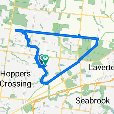
- Bridgewater Way, Truganina to Bakers Rd, Coburg North
- Cuthbert Ave, Truganina to Harrison Ward, Truganina
- 13.8 km
- 51 m
- 50 m
- Williams Landing, Victoria, Australia
- Moderate route in Truganina
- 7.8 km
- 26 m
- 52 m
- Williams Landing, Victoria, Australia
- Bridgewater Way, Truganina to Bridgewater Way, Truganina
- 115.7 km
- 180 m
- 184 m
- Williams Landing, Victoria, Australia
- Bridgewater Way, Truganina to Bridgewater Way, Truganina
- 52.3 km
- 56 m
- 53 m
- Williams Landing, Victoria, Australia
- Isolation Truganina Triangle
- 19.6 km
- 63 m
- 62 m
- Williams Landing, Victoria, Australia
- Harrison Ward, Truganina to Harrison Ward, Truganina
- 116.3 km
- 739 m
- 738 m
- Williams Landing, Victoria, Australia
- Truganina↔ Dixon Veloway (Scenic Return)
- 48.1 km
- 0 m
- 0 m
- Williams Landing, Victoria, Australia
Open it in the app


