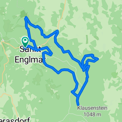
8 Tausender im Bayerwald
A cycling route starting in Sankt Englmar, Bavaria, Germany.
Overview
About this route
Schöne anspruchsvolle Bayerwald Tour mit Anstiegen auf insgesamt 8 mal über 1000m Höhe.
Mit "Ödwies" und dem "Mühlgrabenweg"!
- -:--
- Duration
- 53.1 km
- Distance
- 1,070 m
- Ascent
- 1,070 m
- Descent
- ---
- Avg. speed
- ---
- Avg. speed
Route quality
Waytypes & surfaces along the route
Waytypes
Undefined
53.1 km
(100 %)
Surfaces
Undefined
53.1 km
(100 %)
Continue with Bikemap
Use, edit, or download this cycling route
You would like to ride 8 Tausender im Bayerwald or customize it for your own trip? Here is what you can do with this Bikemap route:
Free features
- Save this route as favorite or in collections
- Copy & plan your own version of this route
- Sync your route with Garmin or Wahoo
Premium features
Free trial for 3 days, or one-time payment. More about Bikemap Premium.
- Navigate this route on iOS & Android
- Export a GPX / KML file of this route
- Create your custom printout (try it for free)
- Download this route for offline navigation
Discover more Premium features.
Get Bikemap PremiumFrom our community
Other popular routes starting in Sankt Englmar
- Untermühlbach und Öd von St. Englmar
- Distance
- 19.3 km
- Ascent
- 732 m
- Descent
- 731 m
- Location
- Sankt Englmar, Bavaria, Germany
- Klinglbach-Grün-Markbuchen-Knogl-Predigstuhl-Pröller
- Distance
- 15.7 km
- Ascent
- 518 m
- Descent
- 516 m
- Location
- Sankt Englmar, Bavaria, Germany
- 8 Tausender im Bayerwald
- Distance
- 53.1 km
- Ascent
- 1,070 m
- Descent
- 1,070 m
- Location
- Sankt Englmar, Bavaria, Germany
- Am Anger 38, Sankt Englmar nach Waldwipfelweg, Sankt Englmar
- Distance
- 5.5 km
- Ascent
- 156 m
- Descent
- 187 m
- Location
- Sankt Englmar, Bavaria, Germany
- Hirschenstein
- Distance
- 21.5 km
- Ascent
- 593 m
- Descent
- 584 m
- Location
- Sankt Englmar, Bavaria, Germany
- Trans_Bayerwald_Sd_Etappe_5_Sankt_Englmar_-_Bischofsmais
- Distance
- 62.1 km
- Ascent
- 2,280 m
- Descent
- 2,494 m
- Location
- Sankt Englmar, Bavaria, Germany
- Sankt Englmar Walter Röhrl Trail Runde
- Distance
- 28.2 km
- Ascent
- 654 m
- Descent
- 667 m
- Location
- Sankt Englmar, Bavaria, Germany
- Mühlgraben - Hirschenstein
- Distance
- 29.7 km
- Ascent
- 1,745 m
- Descent
- 1,743 m
- Location
- Sankt Englmar, Bavaria, Germany