

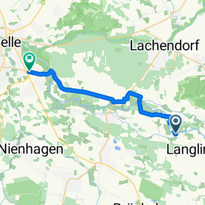
Tour 02 - MTV-Langlingen
A cycling route starting in Langlingen, Lower Saxony, Germany.
Overview
About this route
Leichte Tour!
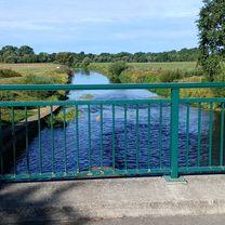
Einzige Herausforderung ist die Brücke über die B214 bei Bröckel oder evtl. Gegenwind!
Leicht wellig ab Lachendorf bis hinter Ahnsbeck.
- -:--
- Duration
- 51.3 km
- Distance
- 75 m
- Ascent
- 75 m
- Descent
- ---
- Avg. speed
- 57 m
- Max. altitude
Route quality
Waytypes & surfaces along the route
Waytypes
Road
19.3 km
(38 %)
Quiet road
11.4 km
(22 %)
Surfaces
Paved
27.5 km
(54 %)
Unpaved
0.3 km
(<1 %)
Asphalt
24.5 km
(48 %)
Paving stones
2.3 km
(4 %)
Continue with Bikemap
Use, edit, or download this cycling route
You would like to ride Tour 02 - MTV-Langlingen or customize it for your own trip? Here is what you can do with this Bikemap route:
Free features
- Save this route as favorite or in collections
- Copy & plan your own version of this route
- Sync your route with Garmin or Wahoo
Premium features
Free trial for 3 days, or one-time payment. More about Bikemap Premium.
- Navigate this route on iOS & Android
- Export a GPX / KML file of this route
- Create your custom printout (try it for free)
- Download this route for offline navigation
Discover more Premium features.
Get Bikemap PremiumFrom our community
Other popular routes starting in Langlingen
 Tour 01 - MTV-Langlingen
- Distance
- 39.7 km
- Ascent
- 49 m
- Descent
- 47 m
- Location
- Langlingen, Lower Saxony, Germany
 Tour 05 - MTV-Langlingen
- Distance
- 52.5 km
- Ascent
- 71 m
- Descent
- 71 m
- Location
- Langlingen, Lower Saxony, Germany
 Rundreise Bockelberge
- Distance
- 25.9 km
- Ascent
- 35 m
- Descent
- 33 m
- Location
- Langlingen, Lower Saxony, Germany
 11. Tag 2010 Langlingen - Thune( Braunschweig)
- Distance
- 53.9 km
- Ascent
- 77 m
- Descent
- 56 m
- Location
- Langlingen, Lower Saxony, Germany
 Im Balken nach Im Balken
- Distance
- 34.6 km
- Ascent
- 61 m
- Descent
- 100 m
- Location
- Langlingen, Lower Saxony, Germany
 Im Balken nach Im Balken
- Distance
- 34.6 km
- Ascent
- 57 m
- Descent
- 100 m
- Location
- Langlingen, Lower Saxony, Germany
 Hohnebostel - Kreuzkrug
- Distance
- 16.5 km
- Ascent
- 45 m
- Descent
- 48 m
- Location
- Langlingen, Lower Saxony, Germany
 Spargeltour 2018 Rücktour
- Distance
- 14.4 km
- Ascent
- 45 m
- Descent
- 51 m
- Location
- Langlingen, Lower Saxony, Germany
Open it in the app