

(4) Kruszyniany i Białowieża
A cycling route starting in Krynki, Podlasie Voivodship, Poland.
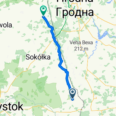
Overview
About this route
Day Four 19.08.2012
CORRATEC X-VERT EXPERT MTB
- -:--
- Duration
- 109 km
- Distance
- 303 m
- Ascent
- 292 m
- Descent
- ---
- Avg. speed
- ---
- Max. altitude

Route quality
Waytypes & surfaces along the route
Waytypes
Quiet road
30.5 km
(28 %)
Road
25.1 km
(23 %)
Surfaces
Paved
60 km
(55 %)
Unpaved
22.9 km
(21 %)
Asphalt
60 km
(55 %)
Gravel
17.4 km
(16 %)
Continue with Bikemap
Use, edit, or download this cycling route
You would like to ride (4) Kruszyniany i Białowieża or customize it for your own trip? Here is what you can do with this Bikemap route:
Free features
- Save this route as favorite or in collections
- Copy & plan your own version of this route
- Split it into stages to create a multi-day tour
- Sync your route with Garmin or Wahoo
Premium features
Free trial for 3 days, or one-time payment. More about Bikemap Premium.
- Navigate this route on iOS & Android
- Export a GPX / KML file of this route
- Create your custom printout (try it for free)
- Download this route for offline navigation
Discover more Premium features.
Get Bikemap PremiumFrom our community
Other popular routes starting in Krynki
 Kruszyniany-Gródek-Leszczany-Kruszyniany
- Distance
- 75 km
- Ascent
- 271 m
- Descent
- 270 m
- Location
- Krynki, Podlasie Voivodship, Poland
 dzien2
- Distance
- 60.9 km
- Ascent
- 295 m
- Descent
- 283 m
- Location
- Krynki, Podlasie Voivodship, Poland
 (4) Kruszyniany i Białowieża
- Distance
- 109 km
- Ascent
- 303 m
- Descent
- 292 m
- Location
- Krynki, Podlasie Voivodship, Poland
 Poczopek - Surażkowo
- Distance
- 20.3 km
- Ascent
- 132 m
- Descent
- 161 m
- Location
- Krynki, Podlasie Voivodship, Poland
 próba kruszyniany
- Distance
- 27.5 km
- Ascent
- 158 m
- Descent
- 161 m
- Location
- Krynki, Podlasie Voivodship, Poland
 Kruszyniany - Poczopek w2
- Distance
- 31.8 km
- Ascent
- 179 m
- Descent
- 161 m
- Location
- Krynki, Podlasie Voivodship, Poland
 Podlaski Szlak Tatarski - day 2
- Distance
- 63 km
- Ascent
- 269 m
- Descent
- 280 m
- Location
- Krynki, Podlasie Voivodship, Poland
 Pierwsza majowa Przechadzka Po Podlasiu - pomagamy Rycerzowi Mikołajowi.
- Distance
- 31.1 km
- Ascent
- 190 m
- Descent
- 184 m
- Location
- Krynki, Podlasie Voivodship, Poland
Open it in the app