

Ride from Mundham to the Downs
A cycling route starting in Chichester, England, United Kingdom.
Overview
About this route
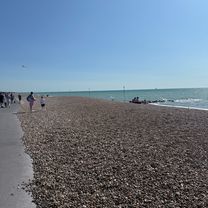
Partly hilly ride, 2 steep ones in the middle.Lovely views.
- -:--
- Duration
- 46.4 km
- Distance
- 356 m
- Ascent
- 357 m
- Descent
- ---
- Avg. speed
- ---
- Max. altitude
Route quality
Waytypes & surfaces along the route
Waytypes
Road
21.8 km
(47 %)
Quiet road
7.9 km
(17 %)
Surfaces
Paved
24.6 km
(53 %)
Unpaved
0.9 km
(2 %)
Asphalt
22.7 km
(49 %)
Concrete
1.4 km
(3 %)
Continue with Bikemap
Use, edit, or download this cycling route
You would like to ride Ride from Mundham to the Downs or customize it for your own trip? Here is what you can do with this Bikemap route:
Free features
- Save this route as favorite or in collections
- Copy & plan your own version of this route
- Sync your route with Garmin or Wahoo
Premium features
Free trial for 3 days, or one-time payment. More about Bikemap Premium.
- Navigate this route on iOS & Android
- Export a GPX / KML file of this route
- Create your custom printout (try it for free)
- Download this route for offline navigation
Discover more Premium features.
Get Bikemap PremiumFrom our community
Other popular routes starting in Chichester
 Harting Route
- Distance
- 83.1 km
- Ascent
- 597 m
- Descent
- 567 m
- Location
- Chichester, England, United Kingdom
 Chichester-Winchester_new3
- Distance
- 61.2 km
- Ascent
- 309 m
- Descent
- 282 m
- Location
- Chichester, England, United Kingdom
 B/GB Chichester - West Dean VV Centurion Way
- Distance
- 8.5 km
- Ascent
- 81 m
- Descent
- 19 m
- Location
- Chichester, England, United Kingdom
 Trundle Plus
- Distance
- 25 km
- Ascent
- 329 m
- Descent
- 326 m
- Location
- Chichester, England, United Kingdom
 salterns Way
- Distance
- 18.5 km
- Ascent
- 8 m
- Descent
- 27 m
- Location
- Chichester, England, United Kingdom
 Woods Road, Chichester to Woods Road, Chichester
- Distance
- 22.6 km
- Ascent
- 103 m
- Descent
- 105 m
- Location
- Chichester, England, United Kingdom
 #supbikerun Event 04 | Chichester | 2015
- Distance
- 27.1 km
- Ascent
- 420 m
- Descent
- 419 m
- Location
- Chichester, England, United Kingdom
 Woods Road, Chichester to Woods Road, Chichester
- Distance
- 32.6 km
- Ascent
- 37 m
- Descent
- 37 m
- Location
- Chichester, England, United Kingdom
Open it in the app