

Thüringisch-Fränkische Begegnung
A cycling route starting in Rödental, Bavaria, Germany.
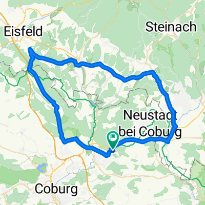
Overview
About this route
between Km 17 and Km 22 unfortunately quite cracked asphalt (ride in the middle if possible)
at Km 35 a short but steep climb
between Rauenstein and Meschenbach so-called 'loose chippings patches'
- -:--
- Duration
- 67.1 km
- Distance
- 704 m
- Ascent
- 708 m
- Descent
- ---
- Avg. speed
- ---
- Max. altitude

Route quality
Waytypes & surfaces along the route
Waytypes
Road
28.9 km
(43 %)
Quiet road
17.5 km
(26 %)
Surfaces
Paved
25.5 km
(38 %)
Unpaved
6 km
(9 %)
Asphalt
25.5 km
(38 %)
Gravel
3.4 km
(5 %)
Route highlights
Points of interest along the route
Point of interest after 2.4 km
Schloß Rosenau
Point of interest after 36.7 km
Point of interest after 36.7 km
"Fleischbaum"
Continue with Bikemap
Use, edit, or download this cycling route
You would like to ride Thüringisch-Fränkische Begegnung or customize it for your own trip? Here is what you can do with this Bikemap route:
Free features
- Save this route as favorite or in collections
- Copy & plan your own version of this route
- Sync your route with Garmin or Wahoo
Premium features
Free trial for 3 days, or one-time payment. More about Bikemap Premium.
- Navigate this route on iOS & Android
- Export a GPX / KML file of this route
- Create your custom printout (try it for free)
- Download this route for offline navigation
Discover more Premium features.
Get Bikemap PremiumFrom our community
Other popular routes starting in Rödental
 Röd-Froschgrundsee-Röd
- Distance
- 19.4 km
- Ascent
- 170 m
- Descent
- 168 m
- Location
- Rödental, Bavaria, Germany
 Kleine Runde gegen Pfunde.
- Distance
- 22.8 km
- Ascent
- 135 m
- Descent
- 135 m
- Location
- Rödental, Bavaria, Germany
 Rund um die Veste Coburg
- Distance
- 59.1 km
- Ascent
- 213 m
- Descent
- 213 m
- Location
- Rödental, Bavaria, Germany
 Auf der Werrabahntrasse zur Werraquelle und die Itz entlang
- Distance
- 65 km
- Ascent
- 653 m
- Descent
- 653 m
- Location
- Rödental, Bavaria, Germany
 durchs Laudertal und Rödental rund um die Schaumburg
- Distance
- 54.8 km
- Ascent
- 475 m
- Descent
- 475 m
- Location
- Rödental, Bavaria, Germany
 Rund um Blumenrod
- Distance
- 22.6 km
- Ascent
- 226 m
- Descent
- 216 m
- Location
- Rödental, Bavaria, Germany
 Thüringisch-Fränkische Begegnung
- Distance
- 67.1 km
- Ascent
- 704 m
- Descent
- 708 m
- Location
- Rödental, Bavaria, Germany
 Rund um die Rosenau
- Distance
- 15.4 km
- Ascent
- 134 m
- Descent
- 134 m
- Location
- Rödental, Bavaria, Germany
Open it in the app